Exploring Burgenland, Part IV: A Visit to Güssing to see a Castle, an Open-Air Museum, and some Panoramic Views, plus some Batthyány Family History
Chasing History: Exploring My Ancestral Roots - Post #71
by Tonya Graham McQuade
In Part I and Part II and Part III of this blog series, I described my husband’s and my June visits to Eisenstadt, Unterwart, and Oberdorf in Burgenland, Austria. I also explained some Burgenland and Hungarian history as I explored my Wagner and Halper family history. Following our visit to Oberdorf, we headed further south to the district of Güssing (aka. Német-Újvár in Hungarian, which means German New Castle,) to see Güssing Castle, the oldest castle in Burgenland. For more than 500 years, it was also home to the powerful Batthyány Family.
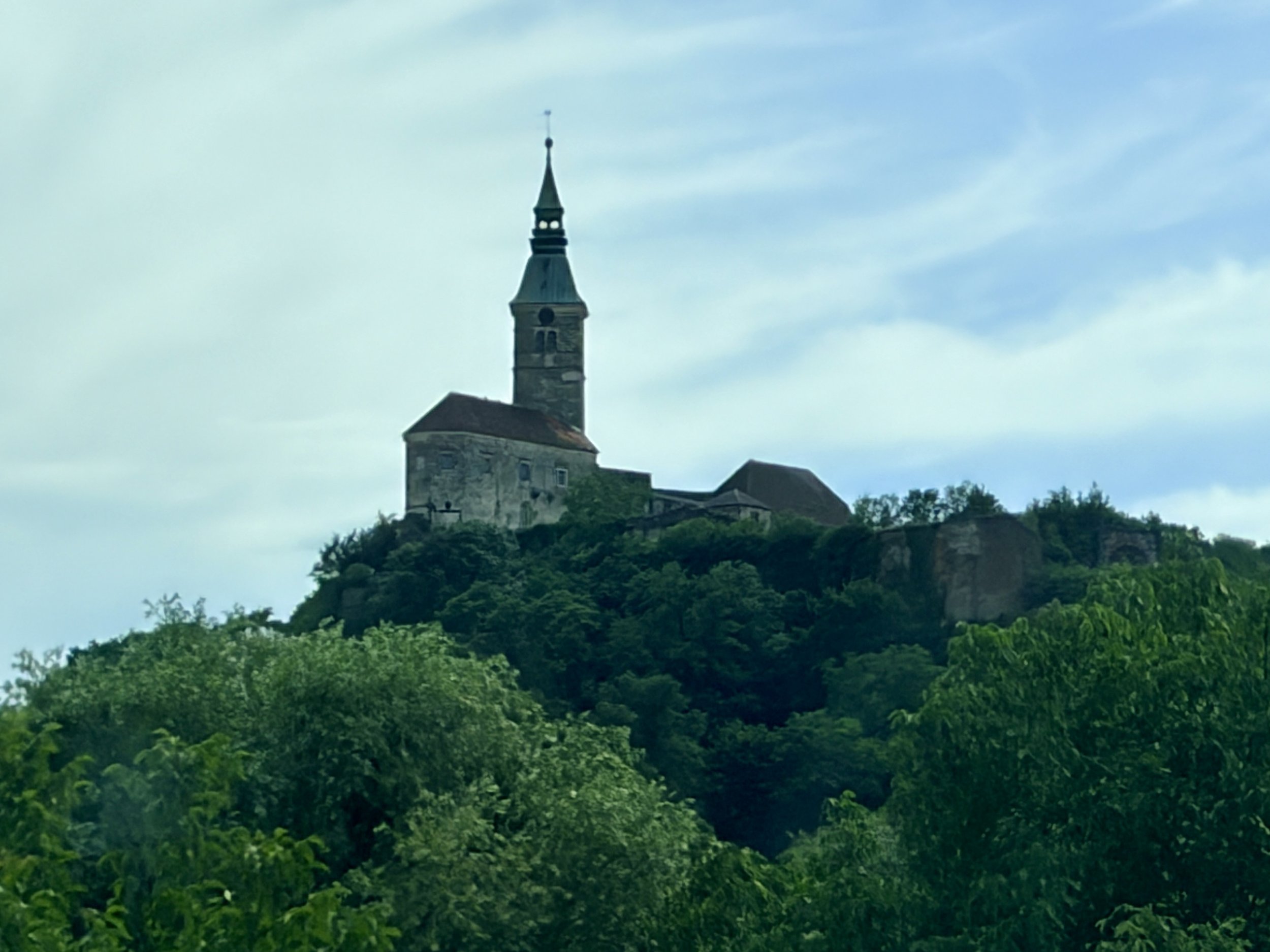
We stopped several times on our drive up to Güssing Castle to admire the view.
The legendary Güssing Castle sits perched atop the dramatic slopes of a 961-foot-high extinct volcanic cone that bulges out of the flat plains of the Strem valley floor. This monument to survival withstood the devastating Mongol invasions of the Middle Ages and served as an impenetrable border shield during the Ottoman wars. Arriving late in the afternoon, we climbed the steep approach roads beneath towering brick bastions and walked through ancient stone archways that have stood guard since the 12th century. (There is also a funicular available for those who do not want to make the climb).
After being gifted Kyscen Mountain and its surroundings by King Géza II of Hungary, the German knight Count Wolfer – recognizing its strategic brilliance – cleared its wild heights in 1157 to construct a “wooden castle” and a monastery. [1] The name of the pilgrimage church Maria Schnee (which will be discussed more later) already appears in documents from that time. That early frontier fortress would eventually evolve into the oldest castle complex in modern Burgenland. Over the centuries, stonemasons carved out chunks of the dark, natural volcanic basalt bedrock from the hill itself to construct the towering outer defensive ring walls, literally fusing the fortress layout directly into the earth. We were able to see those various layers as we hiked to the castle.
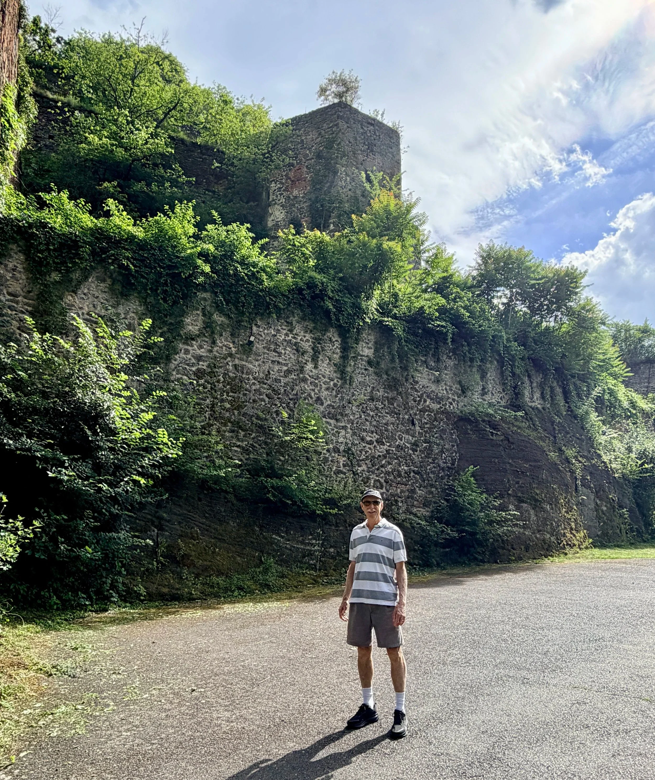
Here you can see Mike on the walk up to the castle, which was definitely a bit of a hike, with the layers of basalt rock and brick visible behind him.
Throughout the Middle Ages, Güssing Castle earned its legendary status by weathering one destructive military crisis after another. In 1241, the brutal Mongol invasion swept across the Kingdom of Hungary, with the Mongol hordes – led by Genghis Khan’s grandson Batu Khan and his tactical genius General Subutai– burning entire villages, wiping out rural populations, and reducing almost every surrounding wooden fortification to ash. Yet, because of its sheer vertical volcanic geography and reinforced stone walls, Güssing was one of the few strongholds to withstand the Mongol siege, offering a safe, heavily armored sanctuary for local refugees who huddled within its high keep.
Centuries later, as the dawn of gunpowder transformed global warfare, the fortress faced its next existential threat from the expanding Ottoman Empire. In 1524, after its having changed hands many times, Hungarian King Ludwig II gifted the estate to Francis I Batthyány (1497 to 1566) as a reward for his heroic defense of the fortress of Jaicza (then-capital of the Kingdom of Bosnia) against the Turks. At the time, in addition to the castle, the Güssing estate included 60 villages. [2] Recognizing the escalating danger of Ottoman raids pushing west toward Vienna, the Batthyány counts transformed the medieval castle into a sprawling, impenetrable, brick-walled fortress that successfully blocked multiple Turkish advances across the valley.
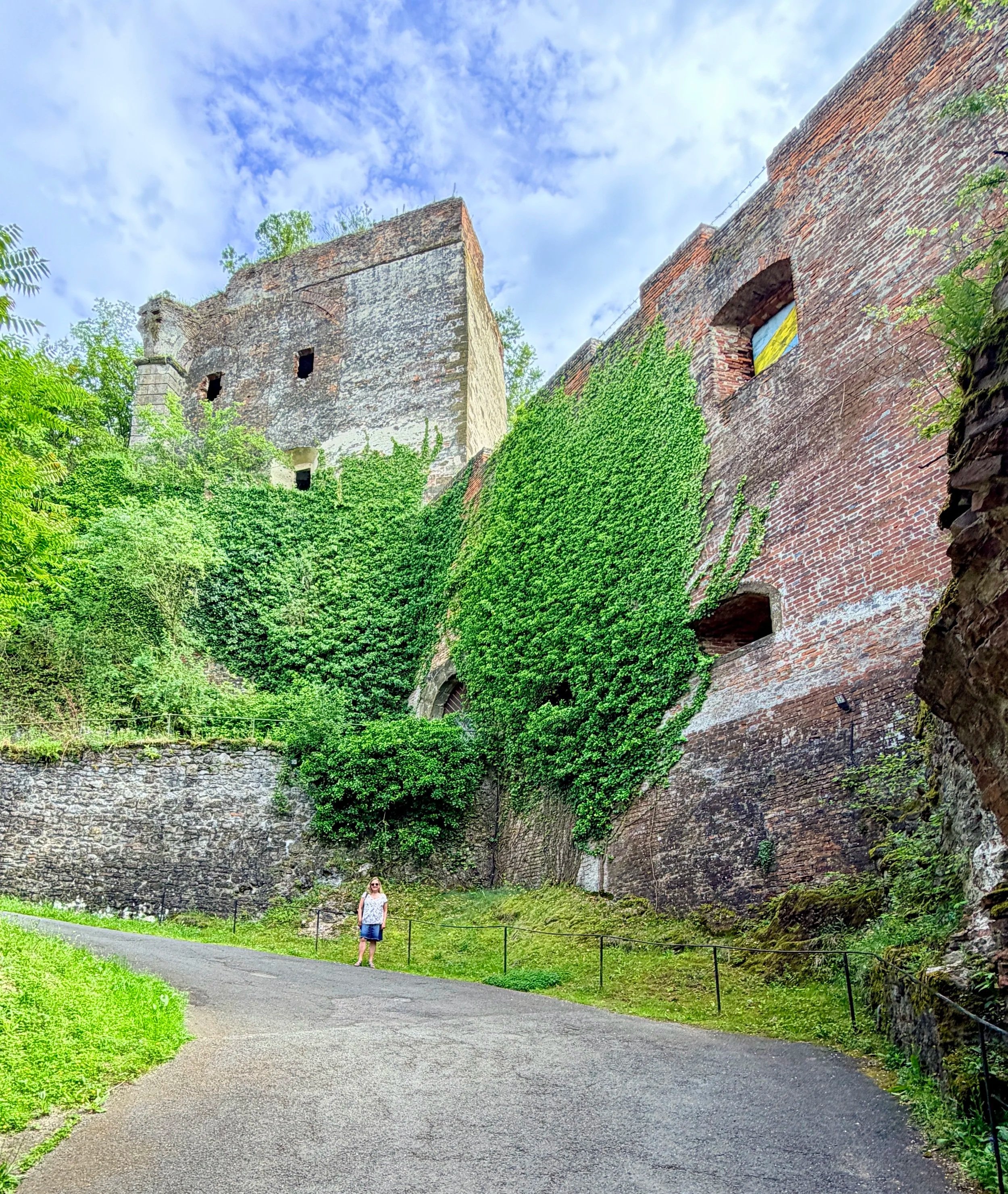
Here you can see the mountain’s black basalt volcanic rock at the far right; I am standing at the foot of the Hochburg (High Keep) fortifications (also on the right), and behind me you can see the Kanonenhalle (Cannon Hall Bastion) of Güssing Castle. Holes previously used for cannons are visible in each.
By making Güssing their permanent ancestral headquarters, the Batthyány princes firmly established themselves alongside the Erdődys of Rotenturm (discussed in Parts II and III) as the two undisputed aristocratic superpowers of Southern Burgenland. Daily living as a peasant in the Pinka or Strem valleys meant navigating life within these two massive estates under these two noble families. The relationship between the Batthyánys and the Erdődys was defined by a complex mix of property friction and family alliances. To consolidate wealth, land, and political power, the two dynasties strategically intermarried multiple times over the 17th and 18th centuries, creating strong ties across both Western Hungary (including Burgenland) and Croatia (where both families also had strong ties and played important political roles).
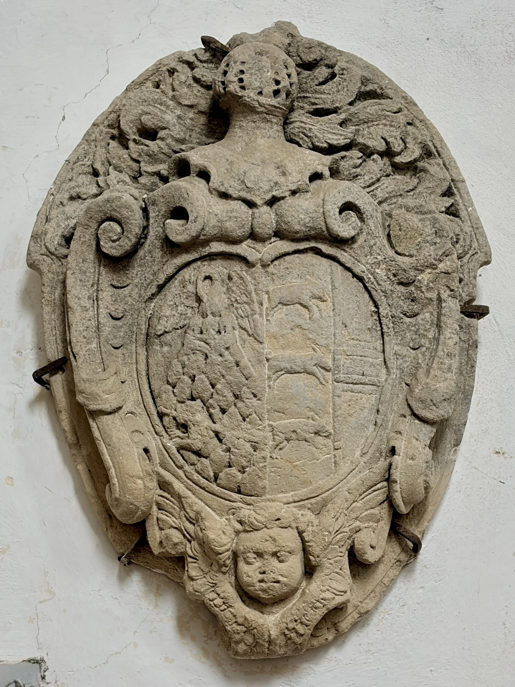
This carved stone coat of arms (Allianzwappen) displays the iconic Batthyány pelican nested right alongside the layered heraldic shield stripes of the Erdődy family, marking a marriage alliance between the two families.
During our visit to the castle chapel, we saw evidence of one of those powerful noble alliances. A beautifully carved stone alliance coat of arms (Allianzwappen) hangs on the wall, displaying the iconic Batthyány pelican nested right alongside the layered heraldic shield stripes of the Erdődy family. In the Batthyány Coat of Arms (which can be seen more clearly in the image below), a silver pelican sits in its nest atop a rock with its young, tearing at its own breast with its beak to nourish the three babies with its blood (meant to show its sacrificial piety and devotion, similar to Christ). At the base, a golden lion carrying a gold-handled Turkish saber in its mouth emerges from a cave. The Latin motto at the bottom states, “Fidelitate et Fortitudine” (Fidelity and Courage).
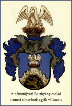
The Batthyány Coat of Arms [3]
According to the Batthyány family’s website, “In 1481, Balthasar I was granted the family coat of arms by King Matthias I Corvinus. Balthasar I (†1520) – whose grandfather Albert (†1435) first called himself Batthyány after the estate Batthyán, which the family received from King Sigismund in 1398 for their services in the fight against the Turks – was Lord Chamberlain under King Matthias I Corvinus.” [4] Additionally “This original motto was changed for the princely line by the 7th Prince, Ladislaus Anton Batthyány-Strattmann, to “Fidelitate et Caritate” (Loyalty and Charity) and has been valid for the princely line ever since.” [5] For further explanations of the Coat of Arms and its changing interpretation, check out THIS LINK.
As an interesting side note, that same 7th Prince is now known as “Blessed László (Ladislaus) Batthyány-Strattmann” after being beatified on March 23, 2003, by Pope John Paul II at the Vatican. Beatification is the final major step in the Catholic Church before full canonization into sainthood. This was the result of his being recognized for his heroic virtue, deep personal faith, and extraordinary charitable work, including his founding of hospitals and his work as a surgeon and ophthalmologist, treating thousands of low-income patients completely free of charge, often paying for their medication and hospital stays out of his own pocket. [6] Many pilgrims, especially from Hungary, visit the Franciscan monastery (Basilica Maria Heimsuchung) in Güssing because the church houses “the shrine of the Blessed Ladislaus Batthyány-Strattmann.” You can read more about him HERE.
But back to Güssing Castle. As the turbulent military threats of the 17th century faded, the outer ramparts of the castle faced another threat: the imperial tax collector. In the late 18th century, Empress Maria Theresa introduced a sweeping fiscal reform known across the Austrian Empire as the "Roof Tax." Under this new law, aristocratic estates were heavily taxed based on the total surface area of usable, roofed structures they owned. Because modern artillery had rendered sprawling medieval stone bastions obsolete, the Batthyány family chose to dodge these exorbitant annual tax bills by exploiting a literal structural loophole. They intentionally ordered the roofs to be completely stripped off the lower barracks, guard quarters, and secondary outer storage buildings. By taking away the timber rafters, the family legally reclassified the lower ramparts as uninhabitable, untaxable ruins. Over the next two centuries, nature stepped in to finish the job, transforming what was once a heavily armed infantry defense line into these rather romantic-looking, open-air stone windows framing the valley sky.
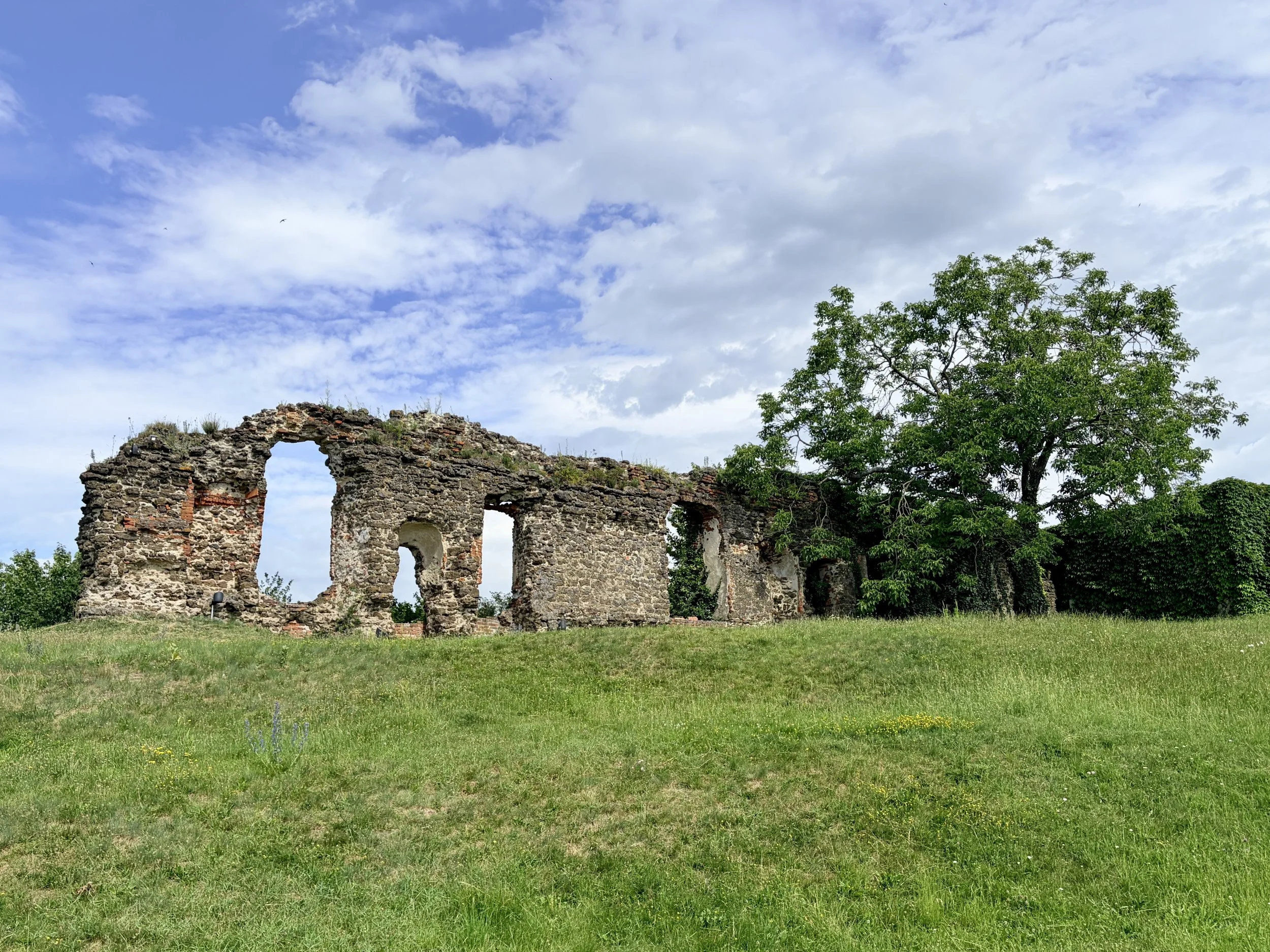
Here you can see the ruins of one of the buildings where the roof was removed.
While the outer ring walls were left to crumble, efforts were put in place to preserve the historic Burgkapelle Maria Schnee (Castle Chapel of Our Lady of the Snow), which caught our attention as we walked around the courtyard. (For an interesting story about the miracle of the namesake “Our Lady of the Snows” in 352 AD and why the gorgeous Basilica of Santa Maria Maggiore was built on Mount Esquiline in Rome, Italy, check out THIS LINK).
Because it was almost closing time, we could not (sadly) go into the castle museum or the family crypt, which houses more than one hundred family coffins and is the second largest family crypt in Austria (after the Imperial Crypt in Vienna). We did, however, have the opportunity to check out the chapel, which dates back to the 12th century. In the photo below, in which Mike is standing in front of the chapel door, you can see evidence of some turbulent history. Whenever Ottoman artillery or lightning fires collapsed the ancient stone walls, the Batthyány counts used millions of locally fired bricks to rapidly patch, reinforce, and expand the outer ramparts during the 1600s and 1700s.
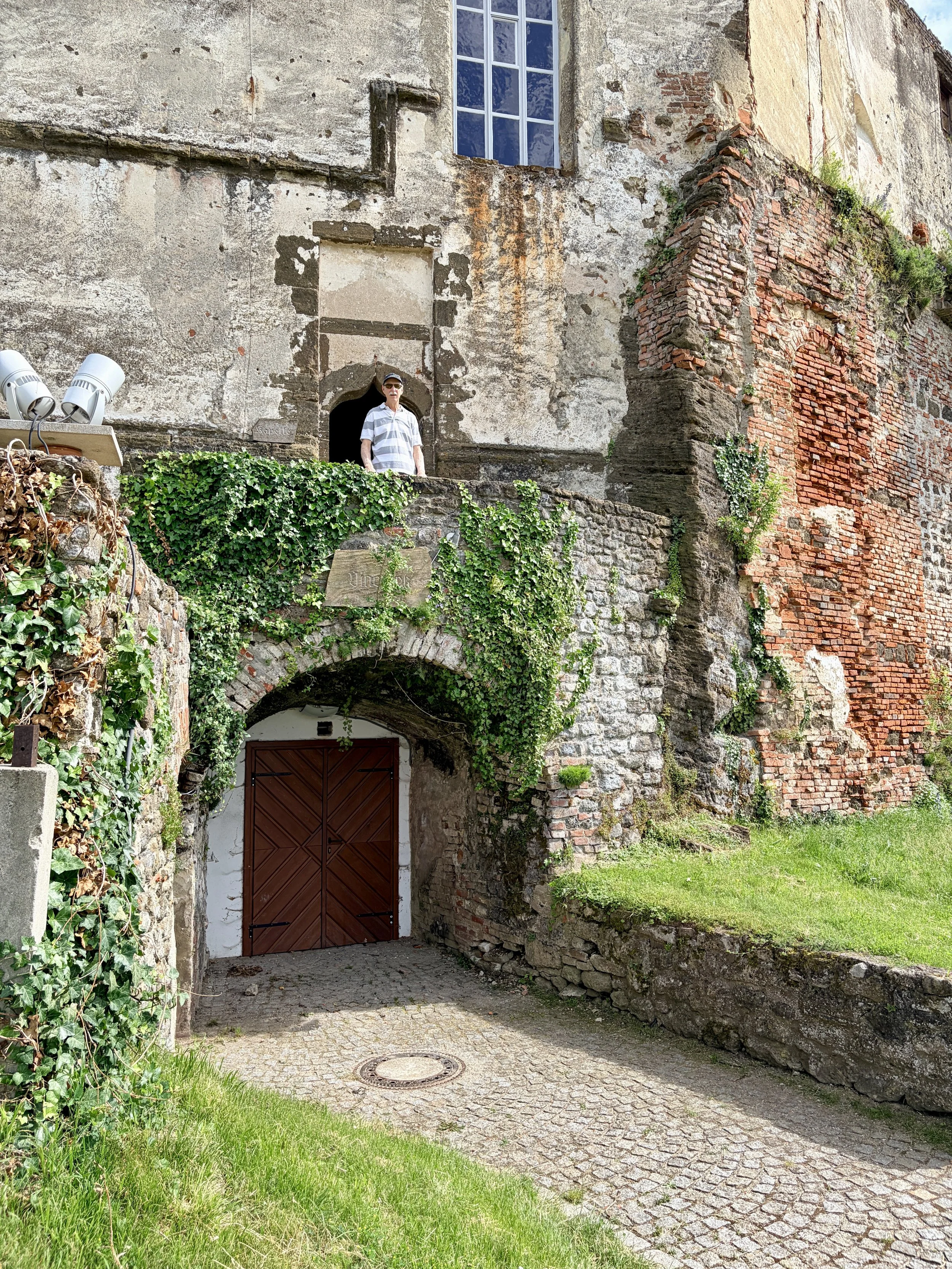
Here you can see Mike standing just outside of the “Burgkapelle Maria Schnee” castle chapel door.
Stepping through the chapel’s beautifully preserved late-Gothic ogee archway reveals the intimate sanctuary supported by 15th-century stone rib-vaulted ceilings that date back to before the Batthyánys. Though the chapel’s earliest medieval furnishings were destroyed by Ottoman sieges and lightning fire, around 1794, the ruling Batthyány princes commissioned a sweeping renovation to completely re-style the sanctuary. The intricate, towering wooden lace gables and pinnacles on the altar were carved at this time to mimic earlier medieval designs. The rows of black frames hanging along the lower walls are the historic Totenschilde (death shields / funeral armorial crests). Whenever a prominent member of the Batthyány family passed away, their personal, highly detailed coat of arms was carried in the funeral procession and permanently mounted inside the chapel to secure their spiritual legacy within the fortress walls before placing their body in the family crypt.
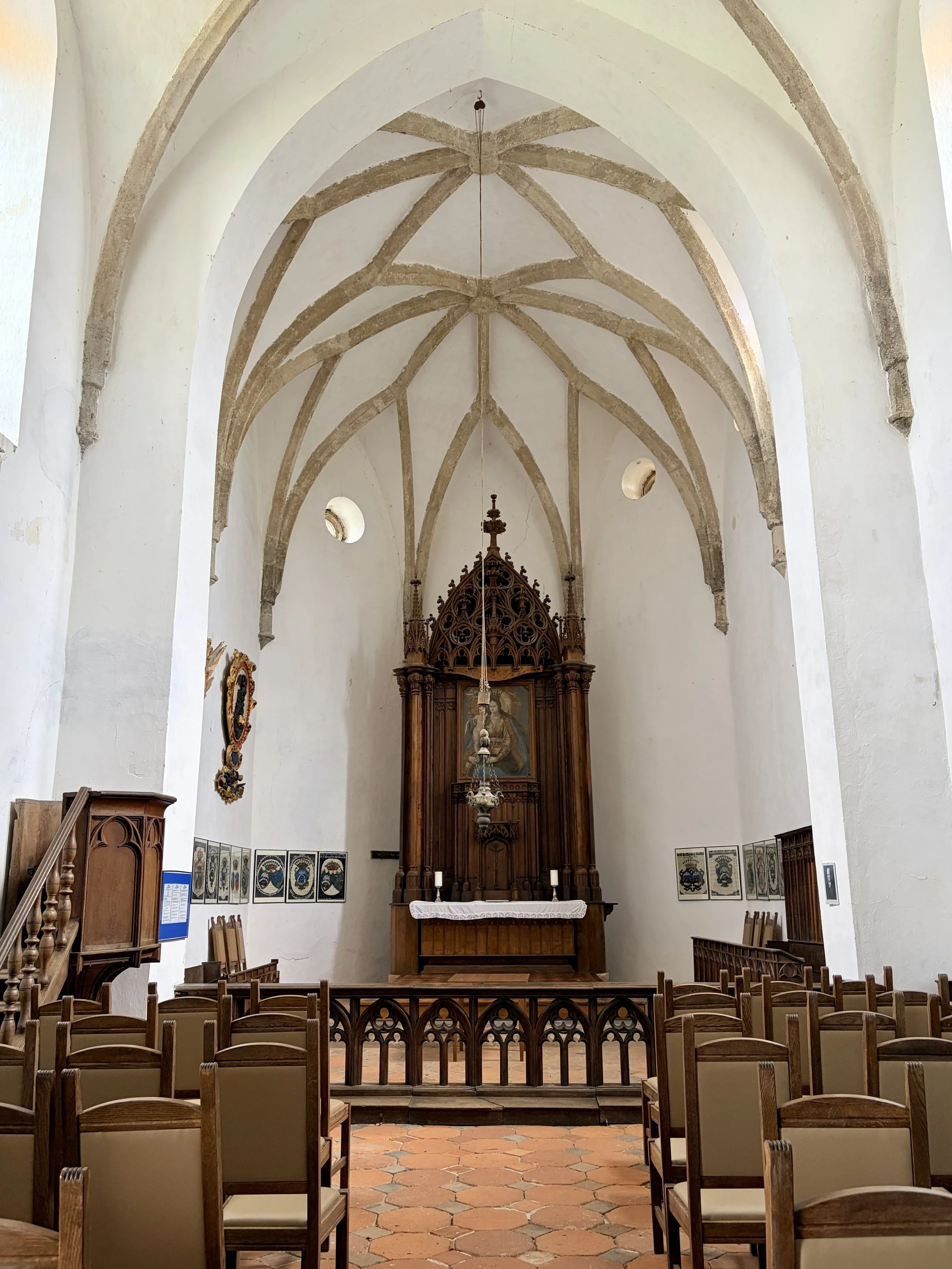
Here you can see the High Altar, which dates back to 1794, as well as the Batthyány Death Shields that line the walls on either side.
Just past the wooden pulpit on the left wall hangs a colorful, gilded 1662 Baroque Side Altar dedicated to Saint James, who appears in the central painting (you can see the Side Altar better in the photo below). The two carved wooden statues standing outside the green columns represent the traditional "Plague Saints" of the 17th century. Because devastating disease outbreaks routinely swept through the local villages, having their images on the altar acted as a spiritual shield for the community. Saint Sebastian stands on the left, shown bound to a tree trunk and pierced with arrows. He was invoked for protection against sudden, deadly pestilence. Saint Roch stands on the right, pointing down toward his thigh to reveal a plague sore. Roch, who became legendary for miraculously curing countless plague victims in Italy simply by making the sign of the cross over them, was the ultimate patron saint sought during local epidemics.
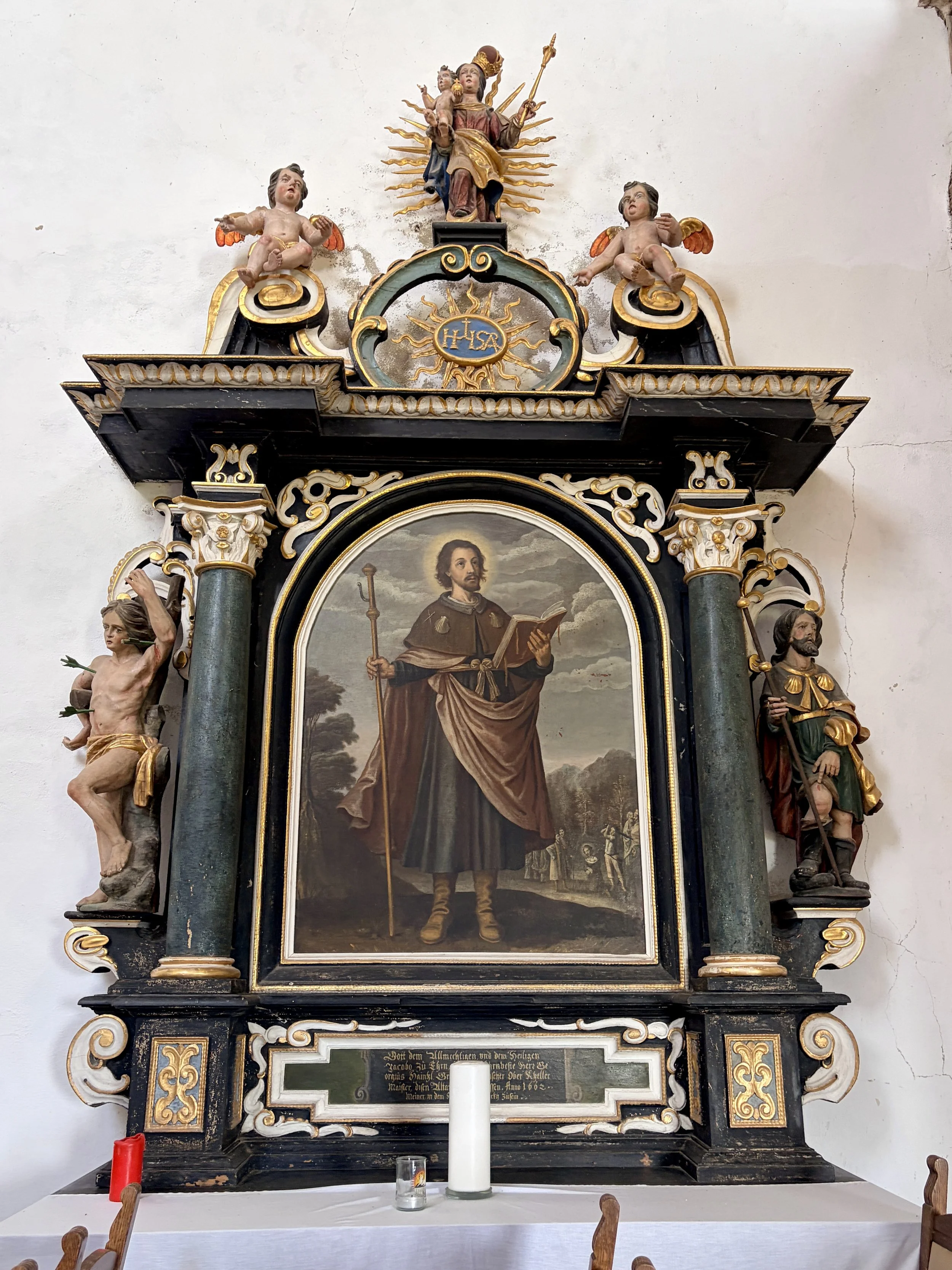
This Side Altar depicts a painting of St. James, with statues of the “Plague Saints” on either side — St. Sebastian on the left and St. Roch on the right.
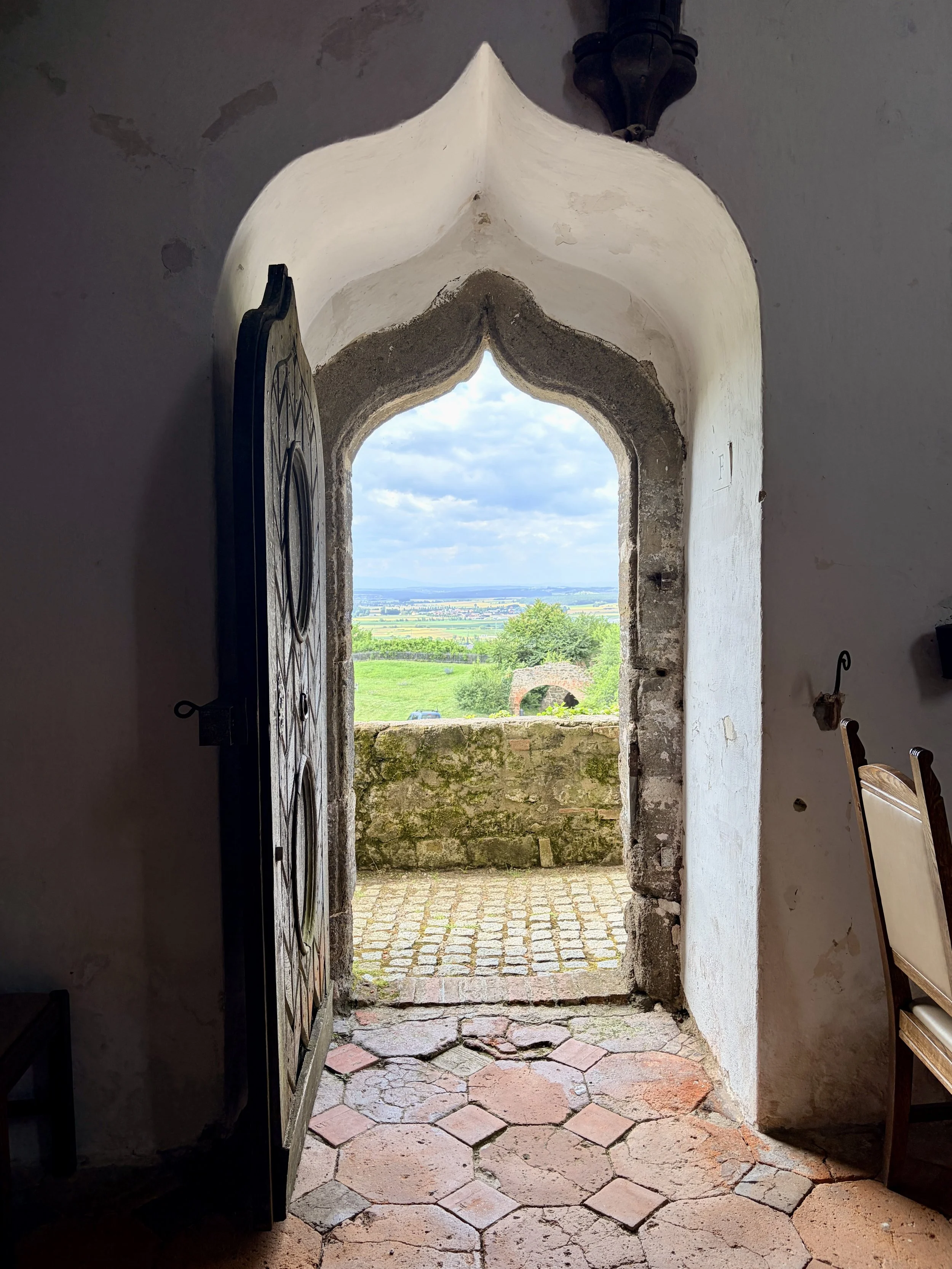
I really liked this view through the arched chapel door, looking out toward the Strem Valley below, and the way the floor transitions from centuries-old, weathered terracotta hexagon tiles inside the chapel to a rugged cobblestone pathway just outside the threshold.
After we finished looking at the chapel, we wandered around outside to see some more of the castle and the panoramic views. The photo below provides a look at the inner courtyard (burghof), with the soaring Castle Tower (Burgturm) in the background. From the copper-roofed tower, guards could look out the windows to watch for any approaching danger. The tower also featured a clock and served as a a bell tower to signal alarms to the valley below. On the right you can see the High Palace (Palas), which housed the royal great hall (Rittersaal), the private living quarters of the Batthyány princes, and the secure administrative offices of the estate lordship. On the left, you can see the Courtyard Arcades with their beautiful arches and flower window boxes. These provided structural support, protection from the elements, and spaces for peaceful contemplation or safe passage.
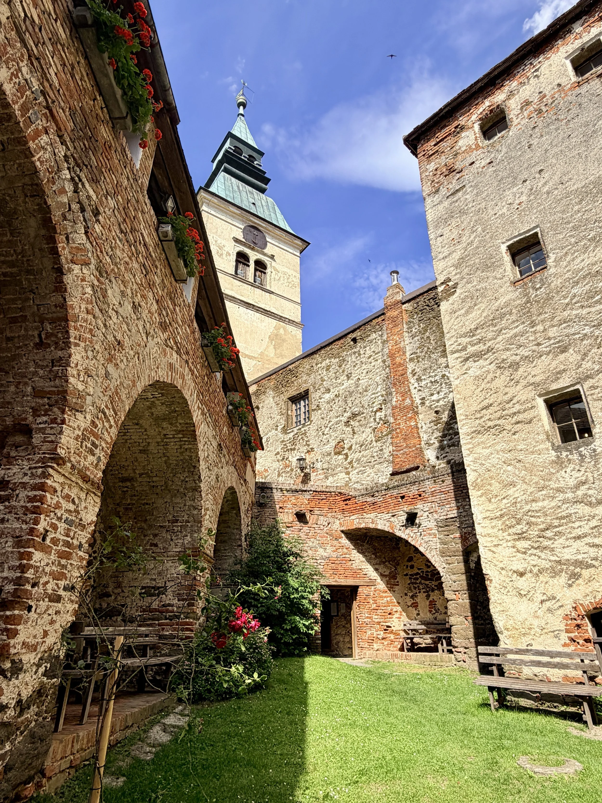
In this photo of the inner courtyard, you can see the Courtyard Arcades on the left, the Castle Tower in the background, and the High Palace on the right.
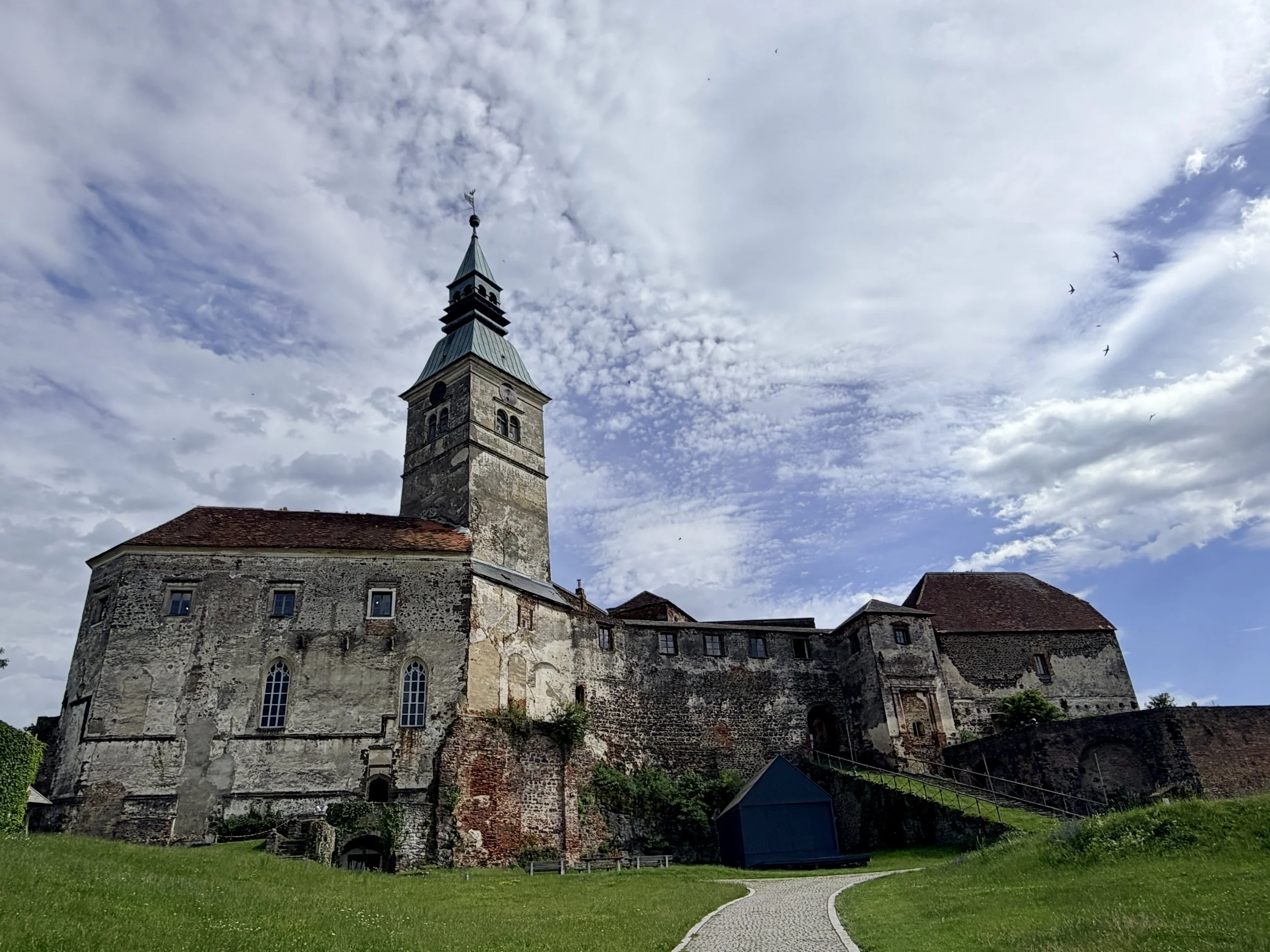
Here you can see the whole complex: Güssing Castle as viewed from the far side.
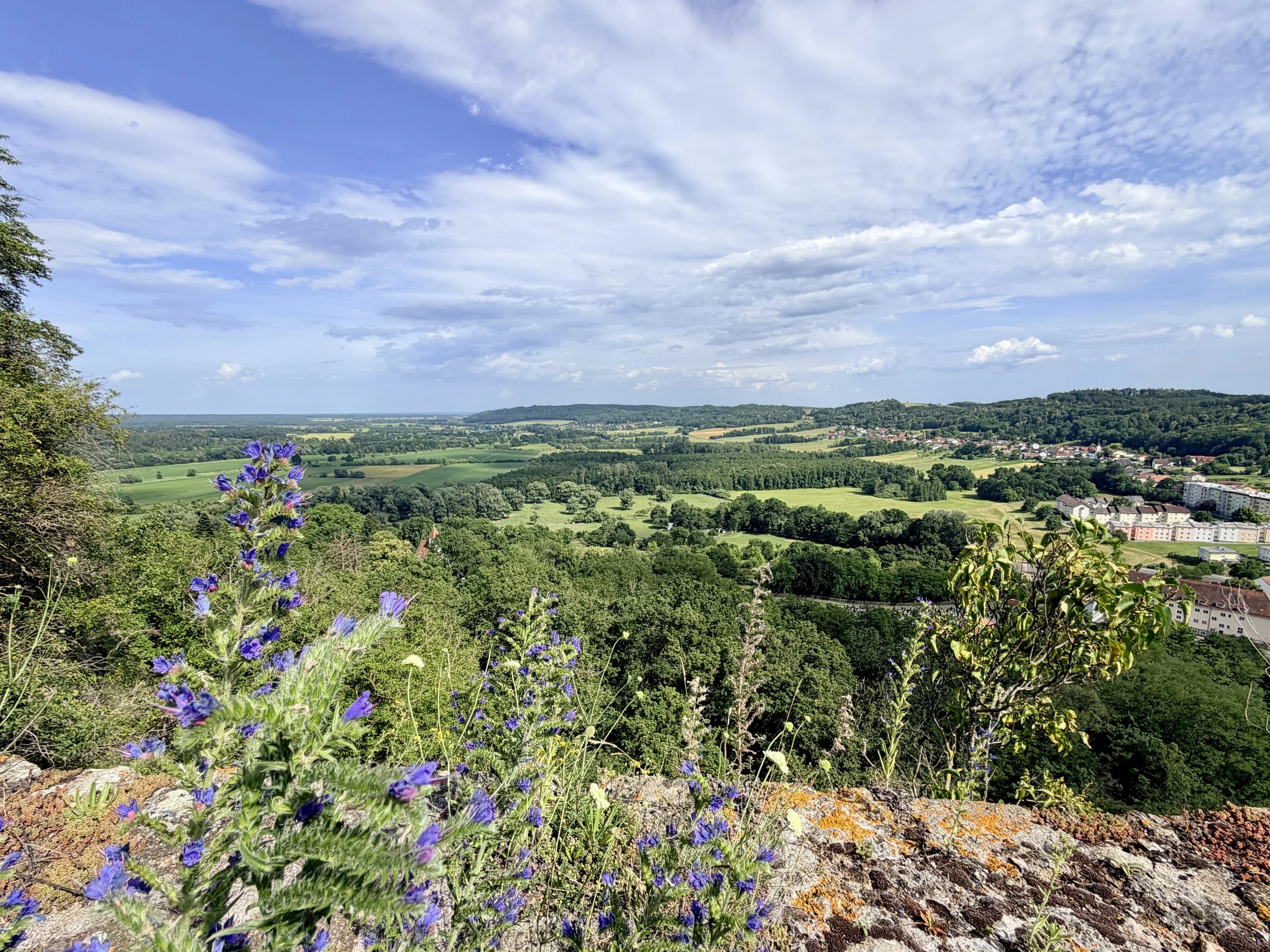
Despite its military history, it felt very peaceful up at Güssing Castle. There were only a few other people there, the sun was shining, it wasn’t too hot or too cold, light clouds were drifting through the sky, and the views were fantastic. Down below us, just over the castle wall, we could see the red roofs of the historic town of Güssing as well as the Güssing fish ponds. In another direction, we saw lots of beautiful fields and wildflowers. Today the castle is operated and managed by the Prince Philipp Batthyány-Strattmann Foundation. At the Burg Castle website, you can learn more about the Pelikan Castle Restaurant that operates on site, as well as the inclined elevator that provides guests “with quick and comfortable access and is the perfect choice for anyone who wants to enjoy the breathtaking views of the area around Güssing without having to face the challenges of a steep climb.” [7]
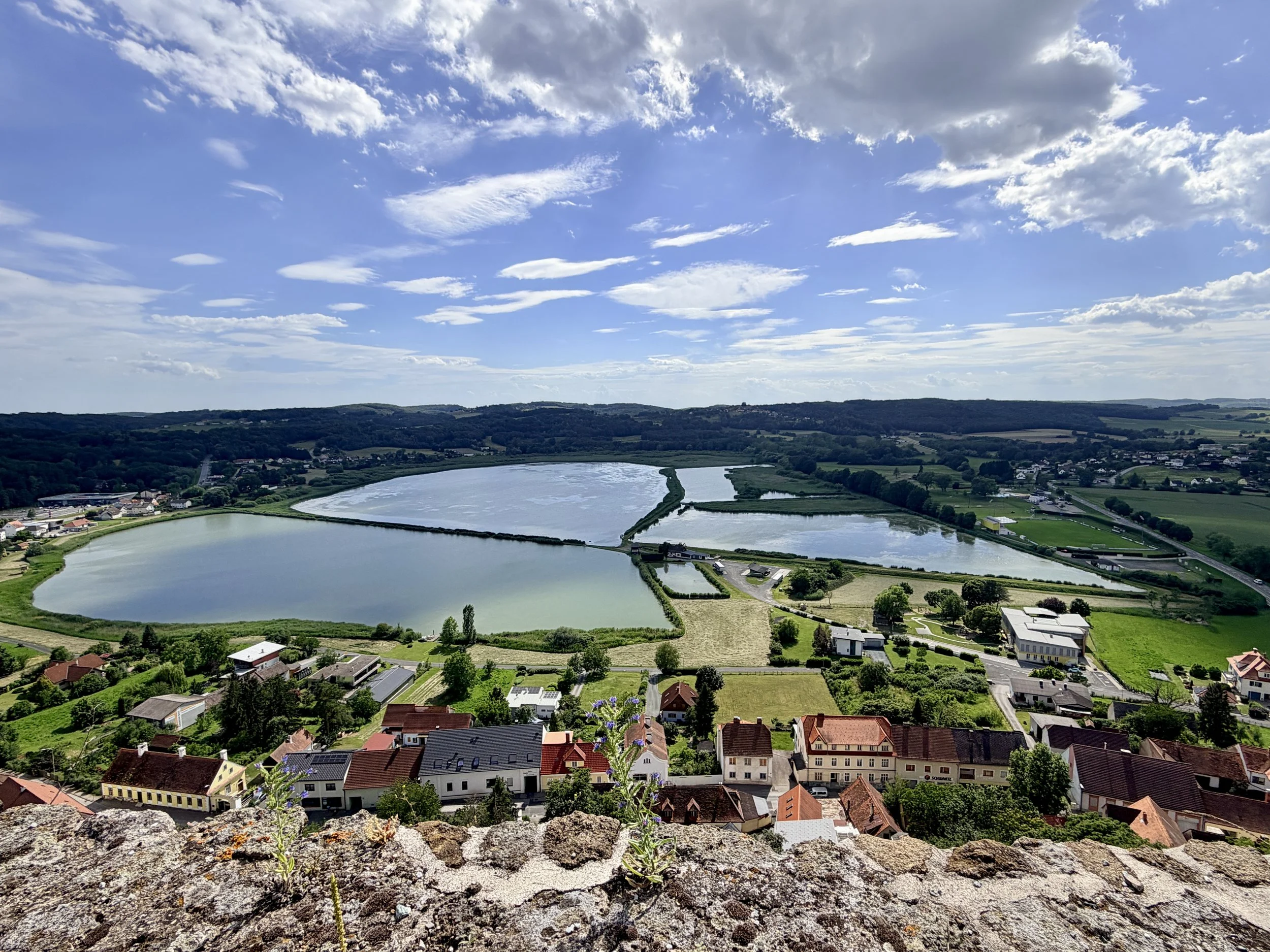
Looking out over the castle wall, we could see the historic town of Güssing (with a population of about 3,600), the Güssing fish ponds, and lots of beautiful hills, fields, trees, and wildflowers.
It was easy to lose track of time during our travels through Burgenland because it didn’t get dark until around 10 p.m. Our stomachs, though, told us it was time for dinner, and we still had a bit of a drive ahead of us to get to our hotel. So, we began our descent from the castle back to our car, then made our way to Burgauberg-Neudauberg on the western edge of the Güssing district in Südburgenland (South Burgenland). Burgauberg-Neudauberg’s western boundary runs along the Lafnitz River, which serves as the historic, natural border between the Austrian states of Burgenland and Styria.
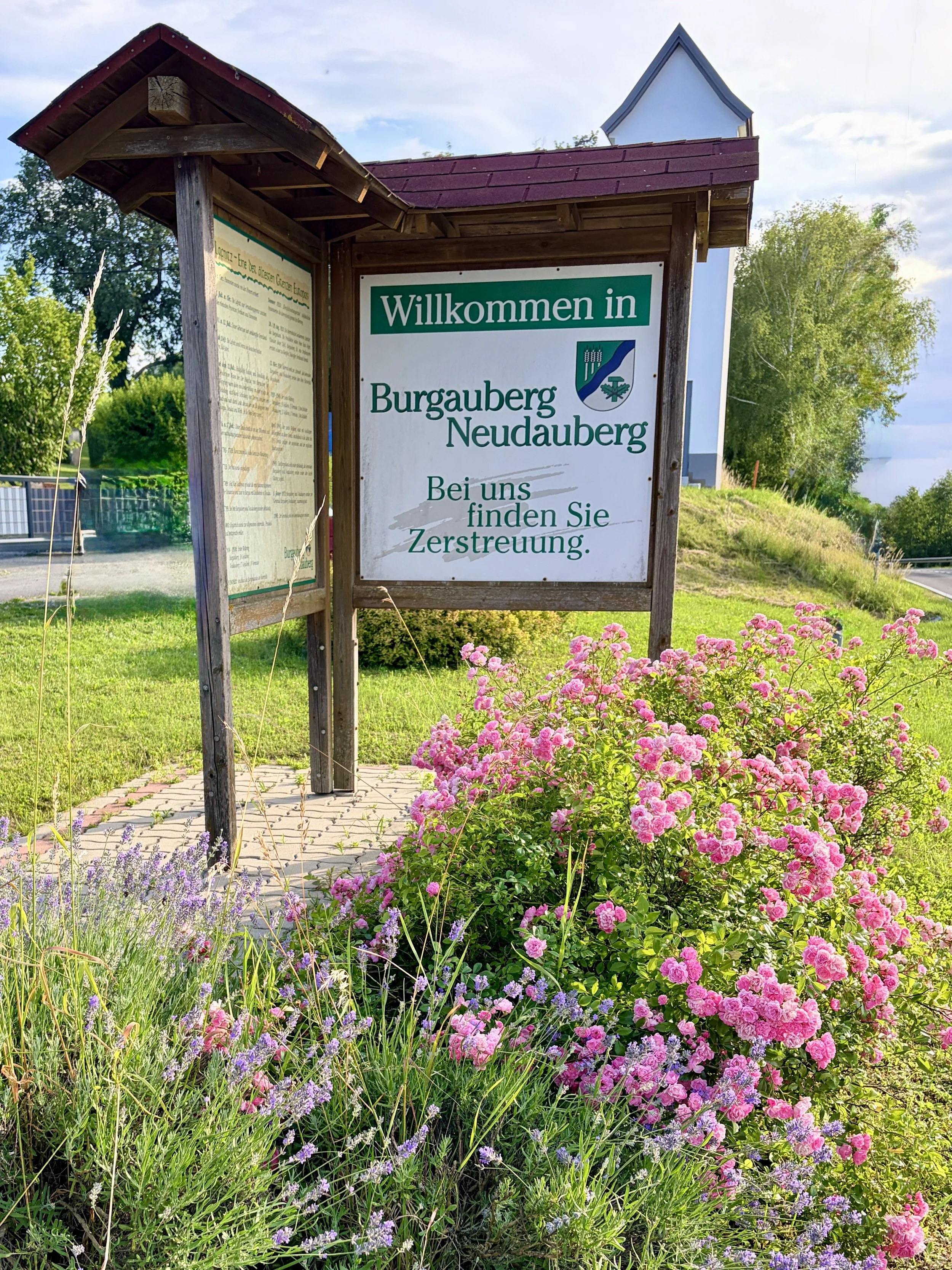
The sign at the entrance to Burgauberg-Neudauberg says, "With us you will find distraction." According to what I read online, the German word “Zerstreuung” is used positively to describe a peaceful escape from daily routines, inviting visitors to relax, unwind, and clear their minds in the countryside.
We had read about the thermal baths in this area and were hoping our hotel might have one, but such was not the case. We did, however, manage to find a place to eat some dinner, then went for a brief “exploratory walk” before returning to our hotel (more of a Bed & Breakfast, actually) to sit on the patio outside our room, drink some local wine, and look out at the beautiful scenery surrounding us before getting some sleep. This area is known for its cycling and e-bike tours, golfing, Nordic walking and hiking, wine tasting, thermal wellness resorts, and nature photography. If I had planned a different type of vacation, one that was more about relaxing and less about traveling and seeing lots of places, this would have been a good place to hang out!
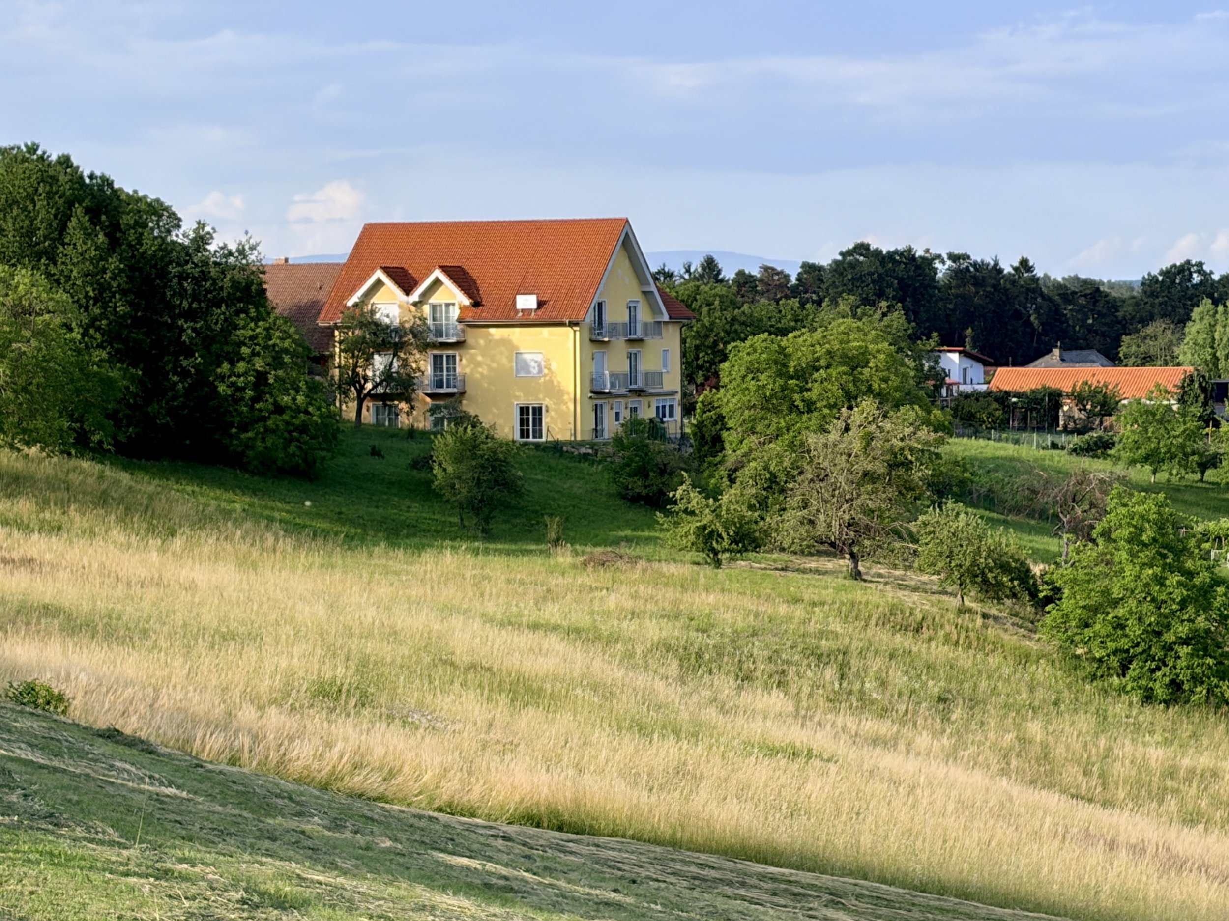
That yellow building is the Hotel / Bed & Breakfast where we stayed, and the window staring right as us on the bottom level was the window to our room, right above our patio.
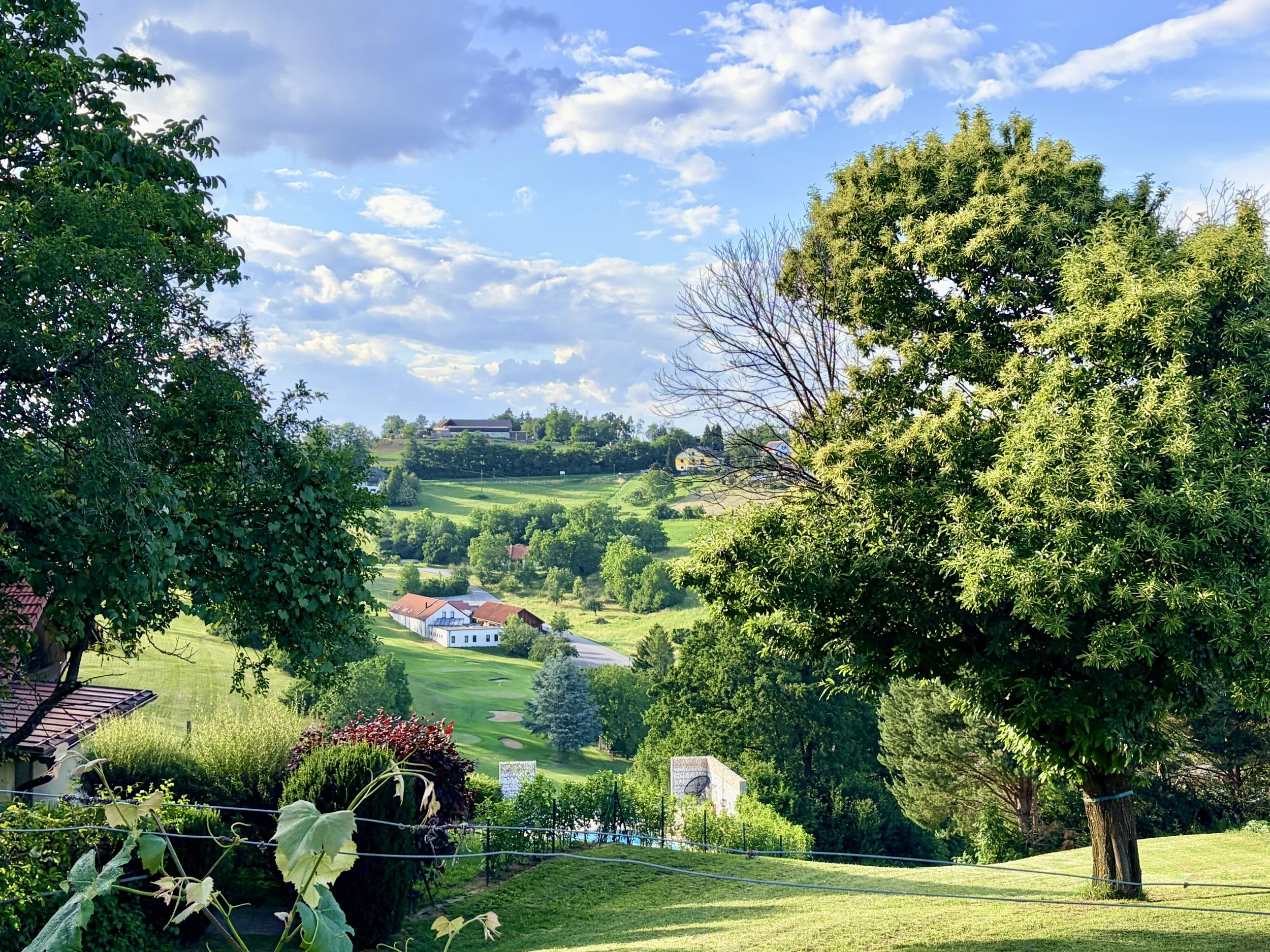
This was our view — that large grassy expanse is actually the sprawling Golfschaukel Stegersbach-Lafnitztal resort complex. This area is famous for twisting its fairways seamlessly through the natural, undulating contours of the old peasant vineyard hills and meadows. (And yes, those are grape leaves in the bottom left corner).
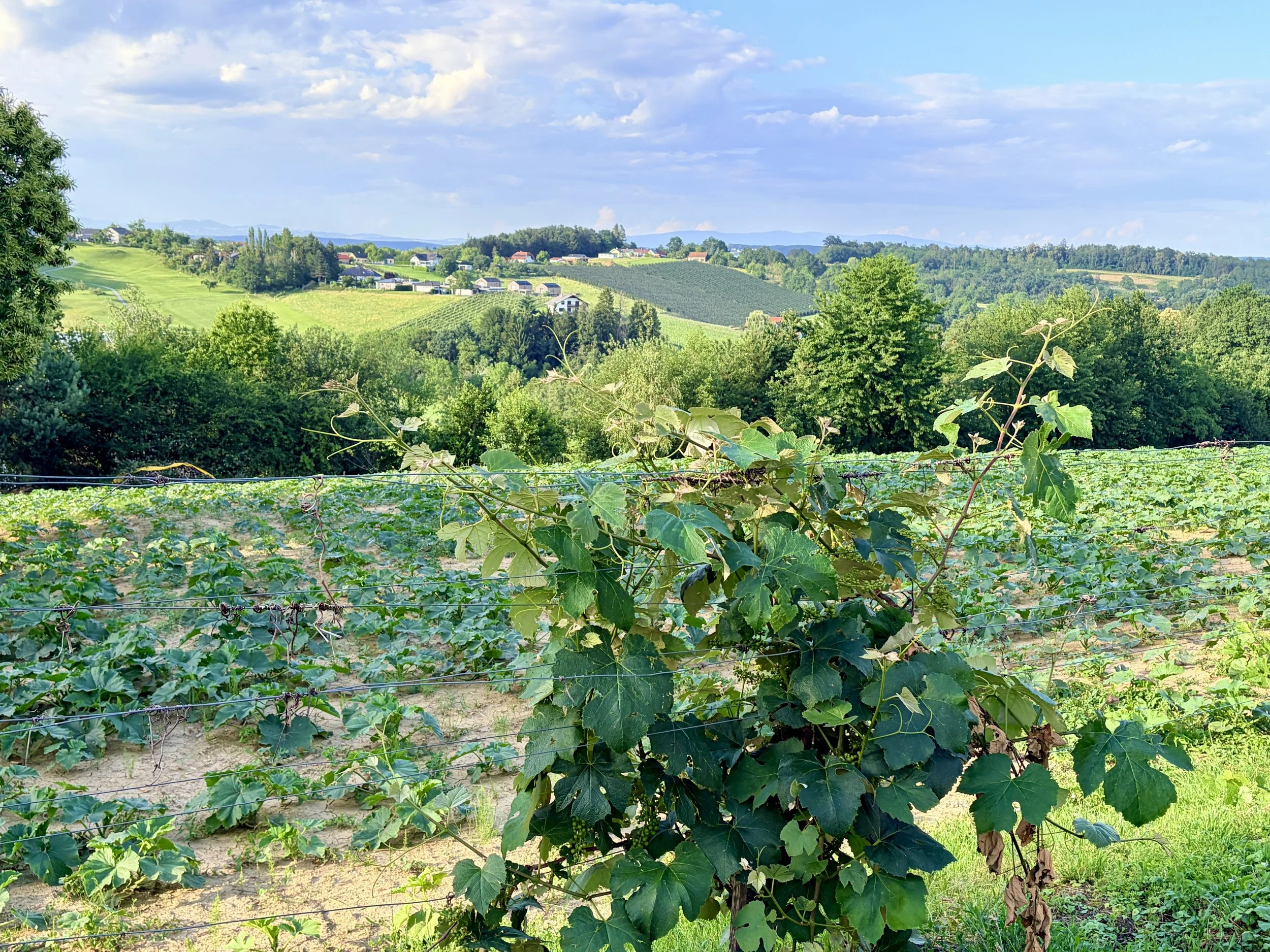
In this view from our walk, you can definitely see LOTS of vineyards; they grow a lot of Uhudler grapes here (that is their specialty), as well as Blaufränkisch, Zweigelt, Welschriesling, Grüner Veltliner (which I drank a lot of on our trip!), and Weissburgunder (Pinot Blanc). I wish we had gotten to do some wine tasting!
In the morning, in pursuit of more panoramic views, we drove to the nearby Aussichtswarte Burgauberg (Burgauberg Observation Tower), an interesting piece of engineering that sits directly on top of a massive concrete water reservoir operated by Wasserverband Thermenland (Thermenland Water Association). This geographical region, spanning southeastern Styria and Southern Burgenland, is known as “Thermenland” (literally "Thermal Spa Land") because of its volcanic hot springs and thermal wellness resorts. We had spotted the tall tower from our hotel and wondered what it was. According to the sign we read near the tower, it is also one of the stops on a 7.8 km trail that encircles the area. Trail signs tell about the region’s cultural achievements, local wildlife, myths and legends, the Kuruc Hungarian insurgents, various local culinary specialties, and the moated castle of the Burgau estate (Wasserschloss Burgau) which for a time was under the control of the Batthyánys.
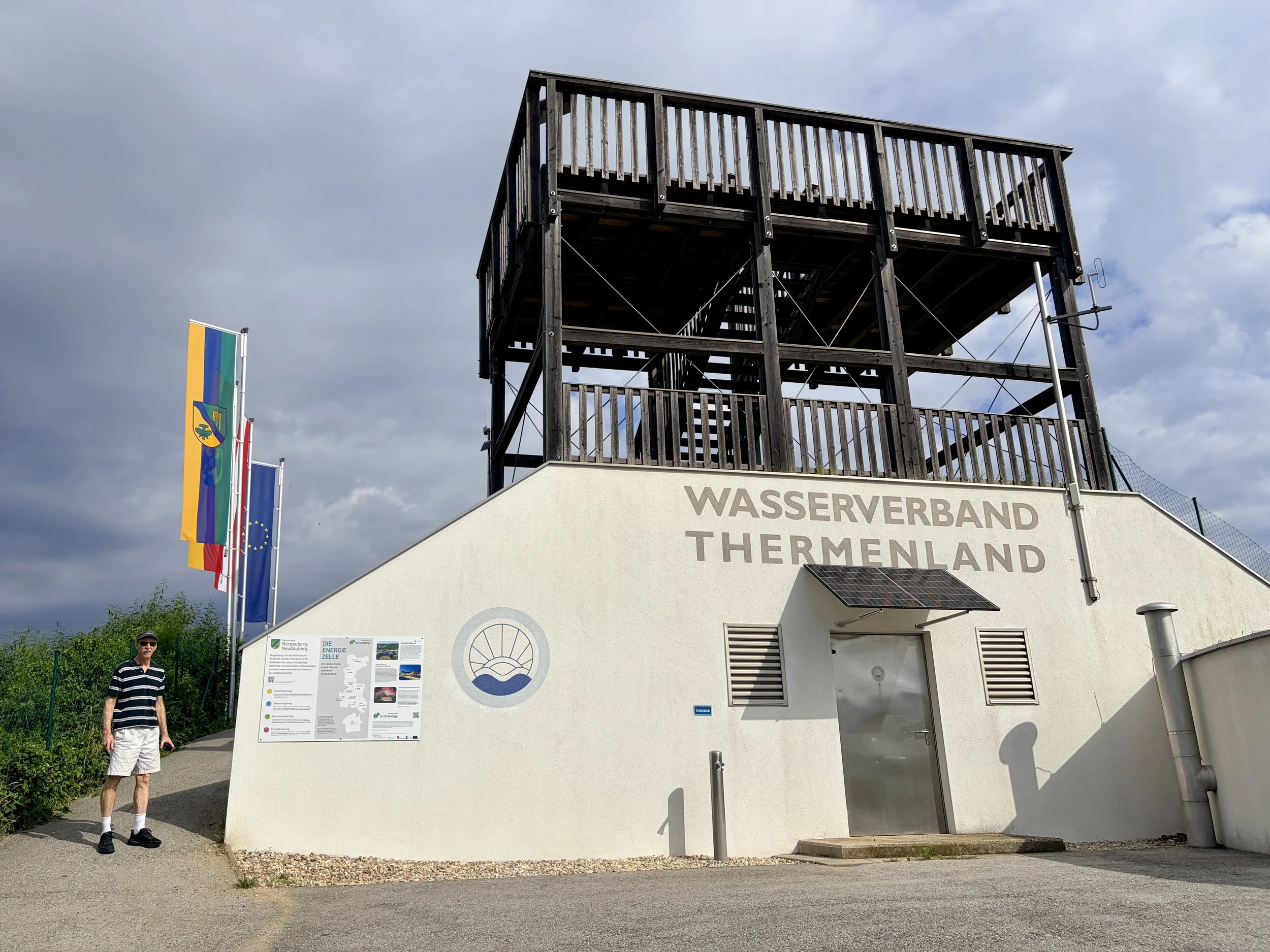
This observation tower overlooking the Lafnitz Valley stands atop massive concrete water reservoir.
We did not have time to walk the trail, but we did climb the observation tower. Standing on the high platform, which stands on the geographic border line separating Burgenland from Styria, we were treated to breathtaking views of the sweeping Austrian hillsides. It was the perfect vantage point to look out over the land of my ancestors and reflect on the centuries of layered history we had “chased” throughout Burgenland. The photo below illustrates the geography of our afternoon journey the day before. Looking out directly above the far-left label on the orientation plaque, you can trace a clear line back toward the volcanic heights of Güssing. From this high ridge in Burgauberg-Neudauberg, the vast network of the old Batthyány estate unfolds.
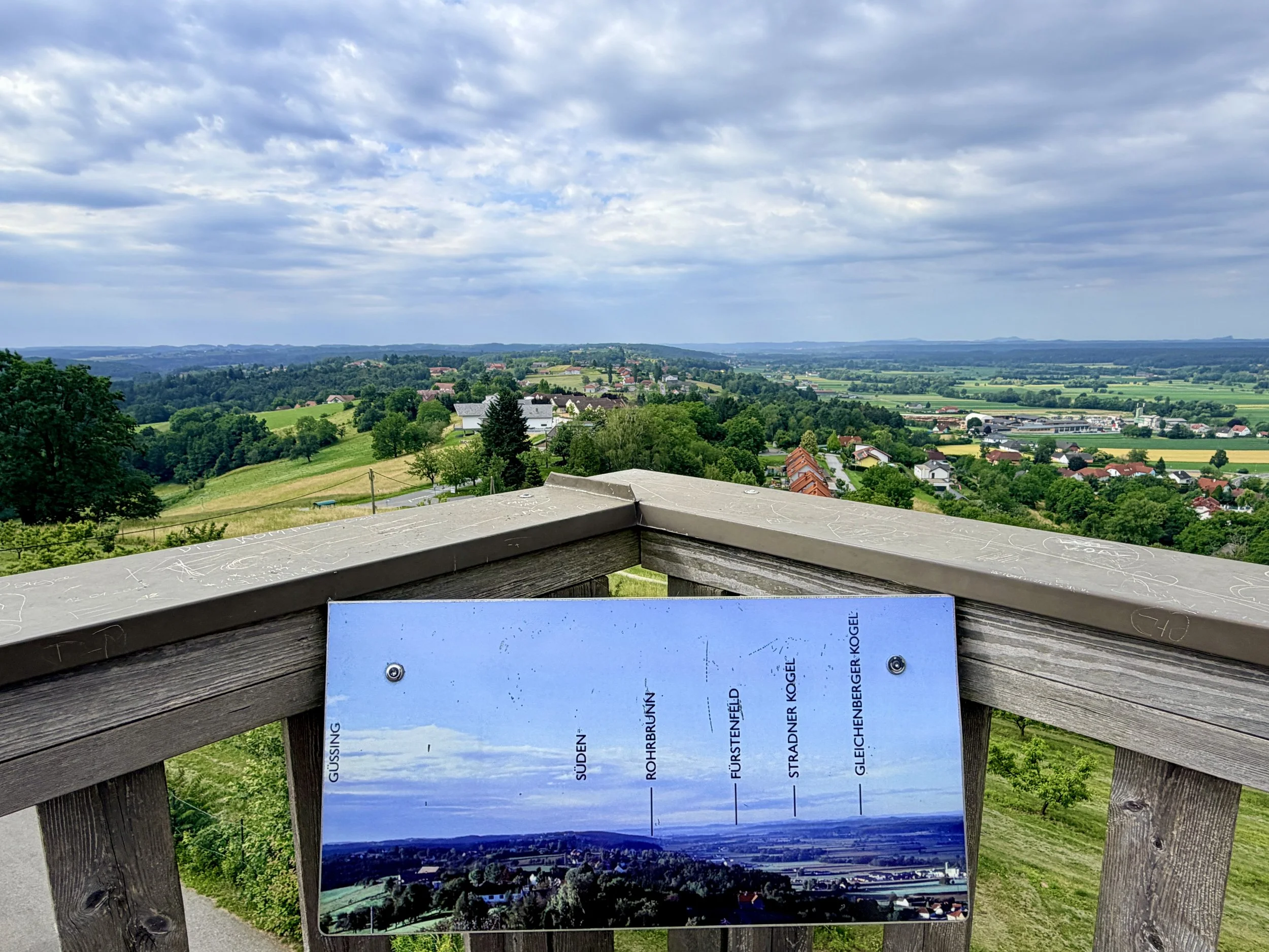
As this sign points out, you can see Güssing in the distance on the far left; all of this land in the Lafnitz Valley at one point was under the control of the Batthyány family.
We had one more stop to make, though, before we left Burgenland: the Freilichtmuseum Ensemble Gerersdorf (aka. The Gerersdorf Open-Air Museum Ensemble). Located in the village of Gerersdorf in the district of Güssing, the Ensemble is the largest open-air museum in Burgenland. It features 36 rescued historic structures, including many thatched-roof residential and farm buildings from the 18th to early 20th centuries, that showcase traditional Pannonian rural life.
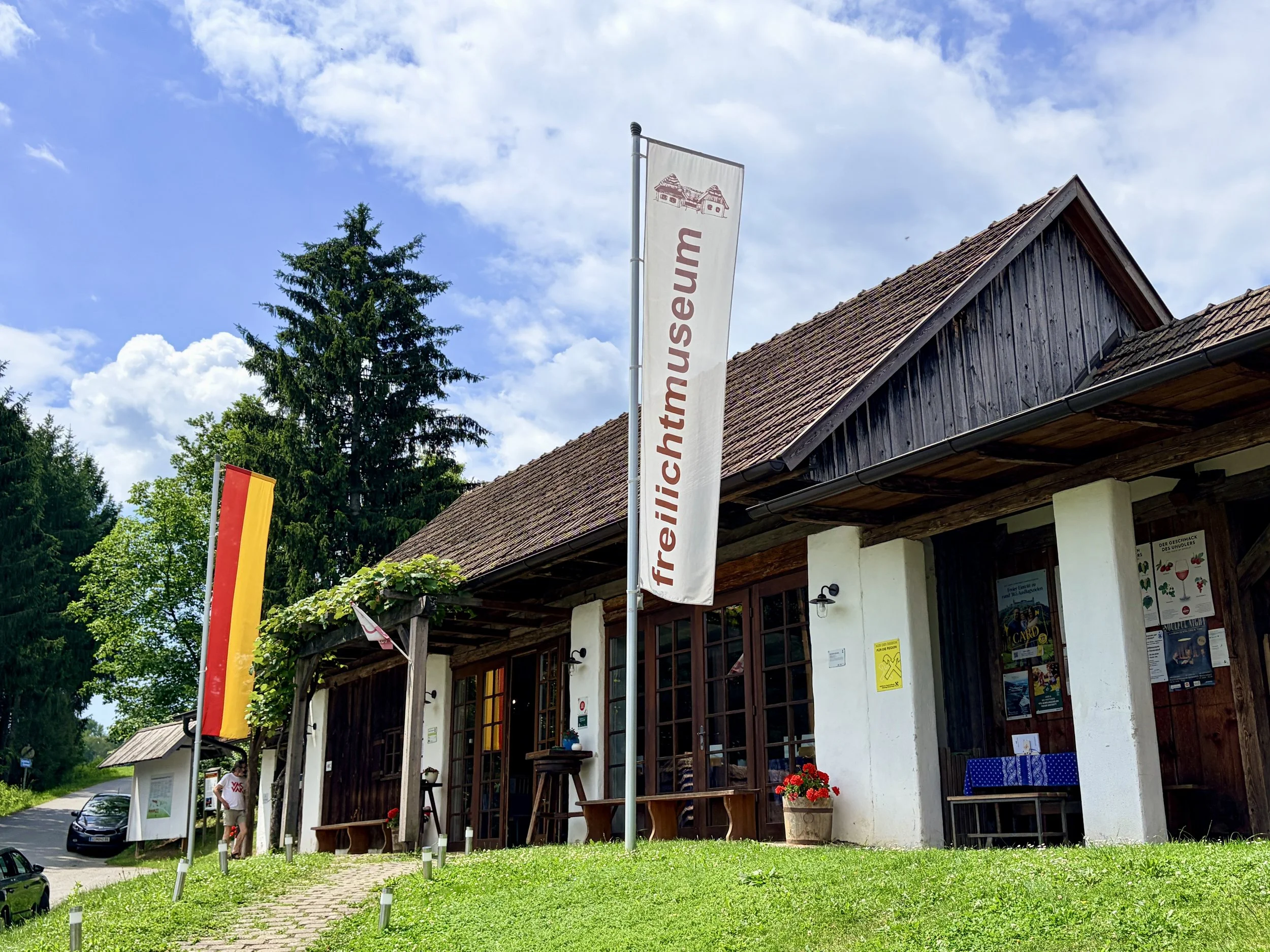
The Freilichtmuseum Ensemble Gerersdorf (aka. The Gerersdorf Open-Air Museum Ensemble) is located in the village of Gerersdorf, which is northwest of the town of Güssing and part of the district of Güssing.
Pannonia was an ancient historical region and former province of the Roman Empire. Today, the term is used to describe the specific geography, climate, and culture of the lowland plains centered around Hungary, which spill directly into eastern Austria (including the Burgenland region). The prehistoric Pannonian Sea that covered this area millions of years ago, leaving behind incredibly fertile soil. The Pannonian plain is surrounded by the Alps, the Carpathians, and the Dinaric Alps. In the context of the museum, “Pannonian” refers specifically to the traditional rural building style featured in the ensemble. These homes feature long, narrow layouts, whitewashed mud or timber walls, and steep, straw-thatched roofs adapted to withstand the dry, windy climate of the eastern plains.
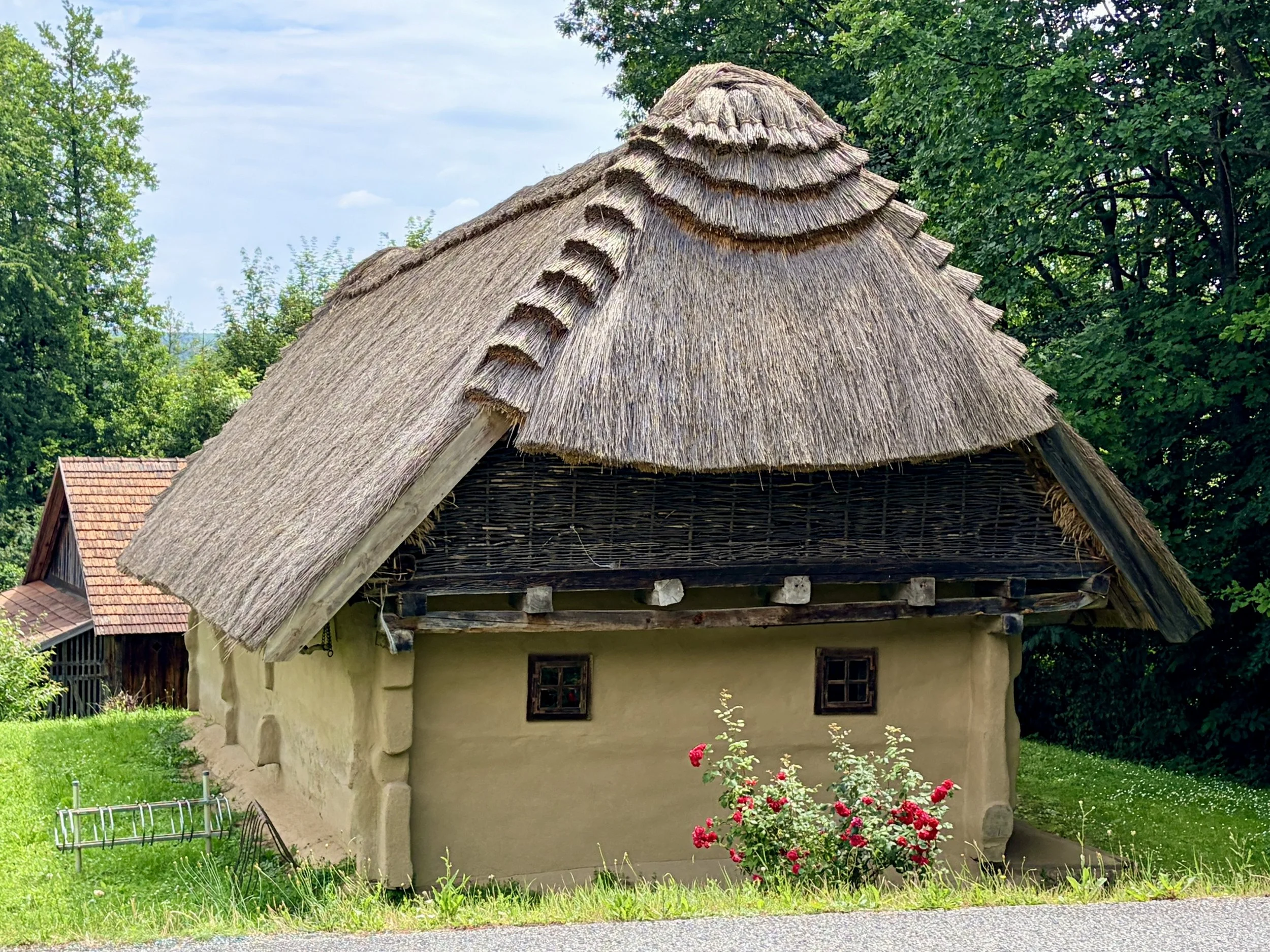
Many of the building feature long, narrow layouts, whitewashed mud or timber walls, and steep, straw-thatched roofs.
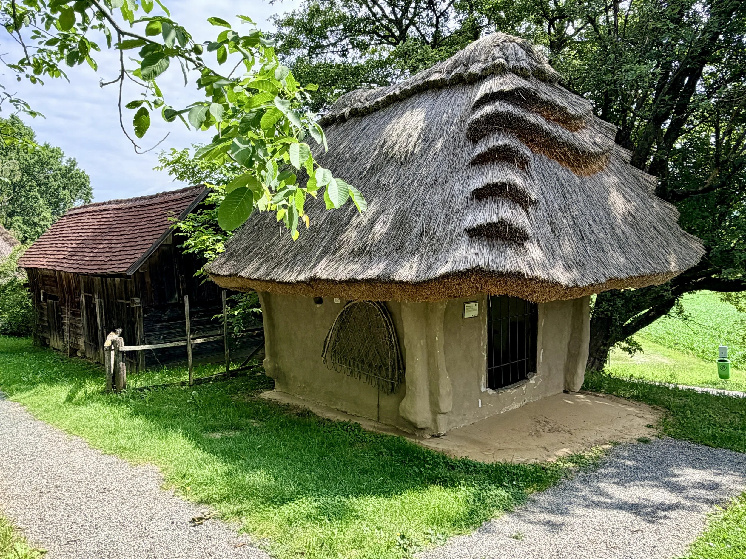
So, what can you see at the museum? Lots of things, including various types of barns, residential buildings, press houses, a bell tower, a tavern, village shops, trade workshops, pigsties, dovecotes, beehives, and more. For a complete list with descriptions, check out THIS LINK. Thousands of rural artifacts are also featured, including authentic farming and household tools, dishes and utensils, winemaking equipment, furniture, clothing, shoes, bedding, toys, arts and crafts, carriages, and sewing machines.
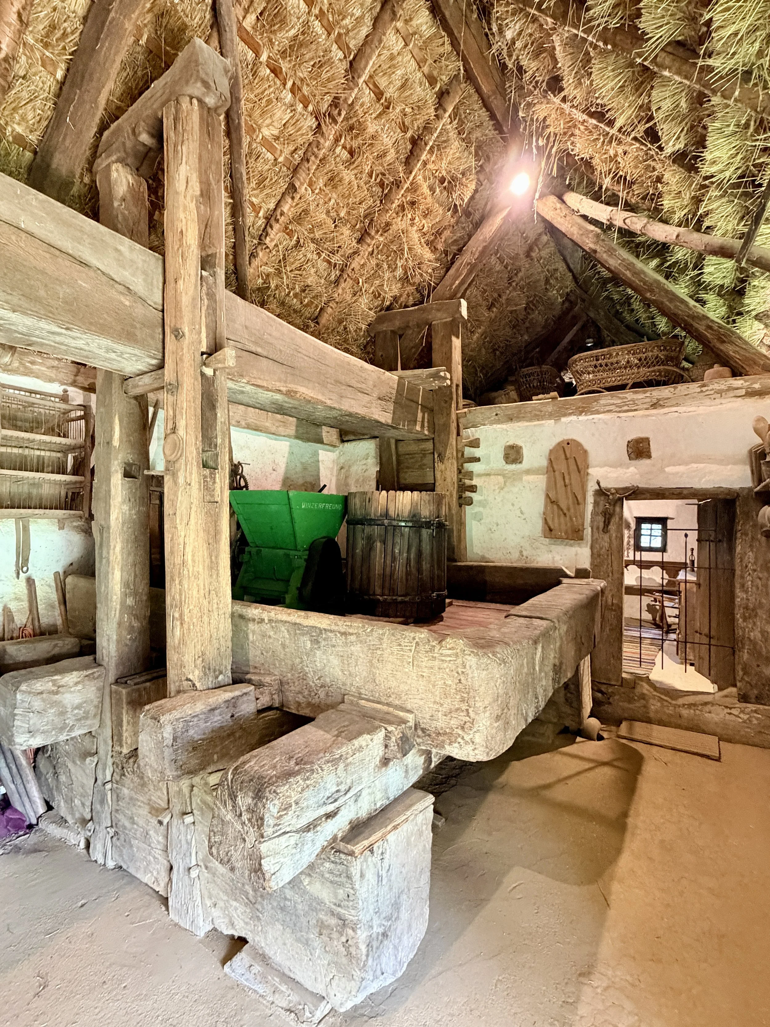
This was one of several Press Houses filled with wine barrels and wine making equipment.
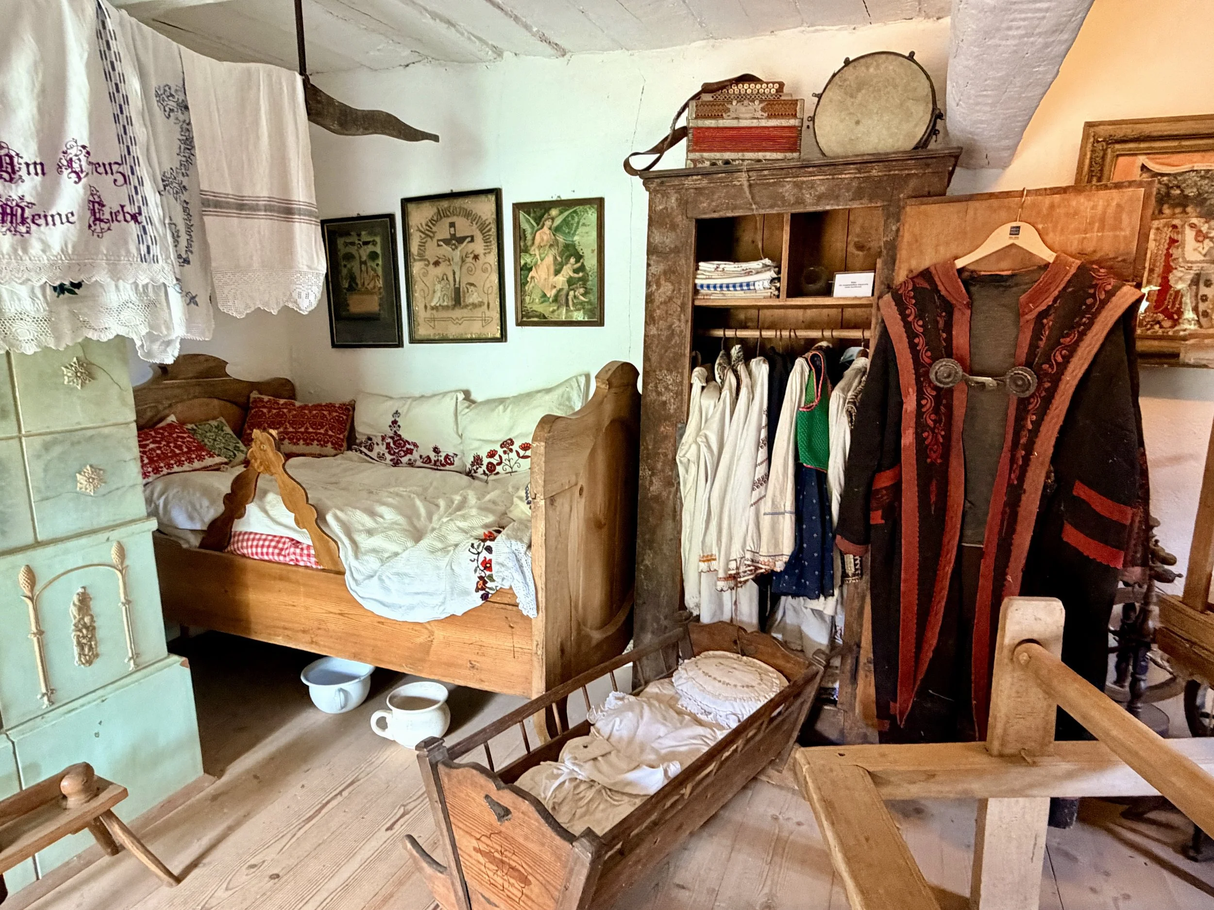
Here you can see what a typical bedroom might have looked like.
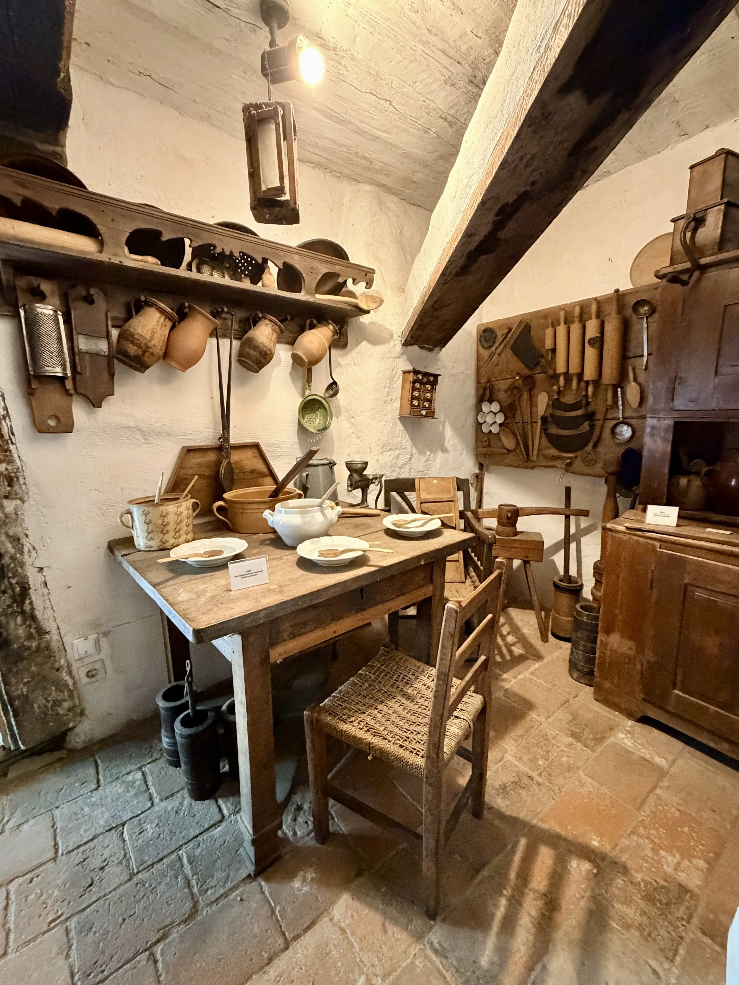
Here you can see a kitchen with lots of dishes and cooking tools.
And how did all this get started? As explained on the museum’s website, “When Gerhard Kisser, a Viennese, first came to southern Burgenland in 1970, he found the last thatched-roof house in the village at the foot of the Gerersdorf Riegelberg hill, and he instantly fell in love with it – especially with its still-original smokehouse. He was fascinated by the beauty of southern Burgenland's traditional wooden architecture with its thatched roofs, which were increasingly falling into disrepair everywhere at the time. So, in 1972, he acquired this first property, followed later by further land purchases. His aim was to relocate these culturally and historically valuable log buildings to this area and thus save them from complete ruin.” [8]
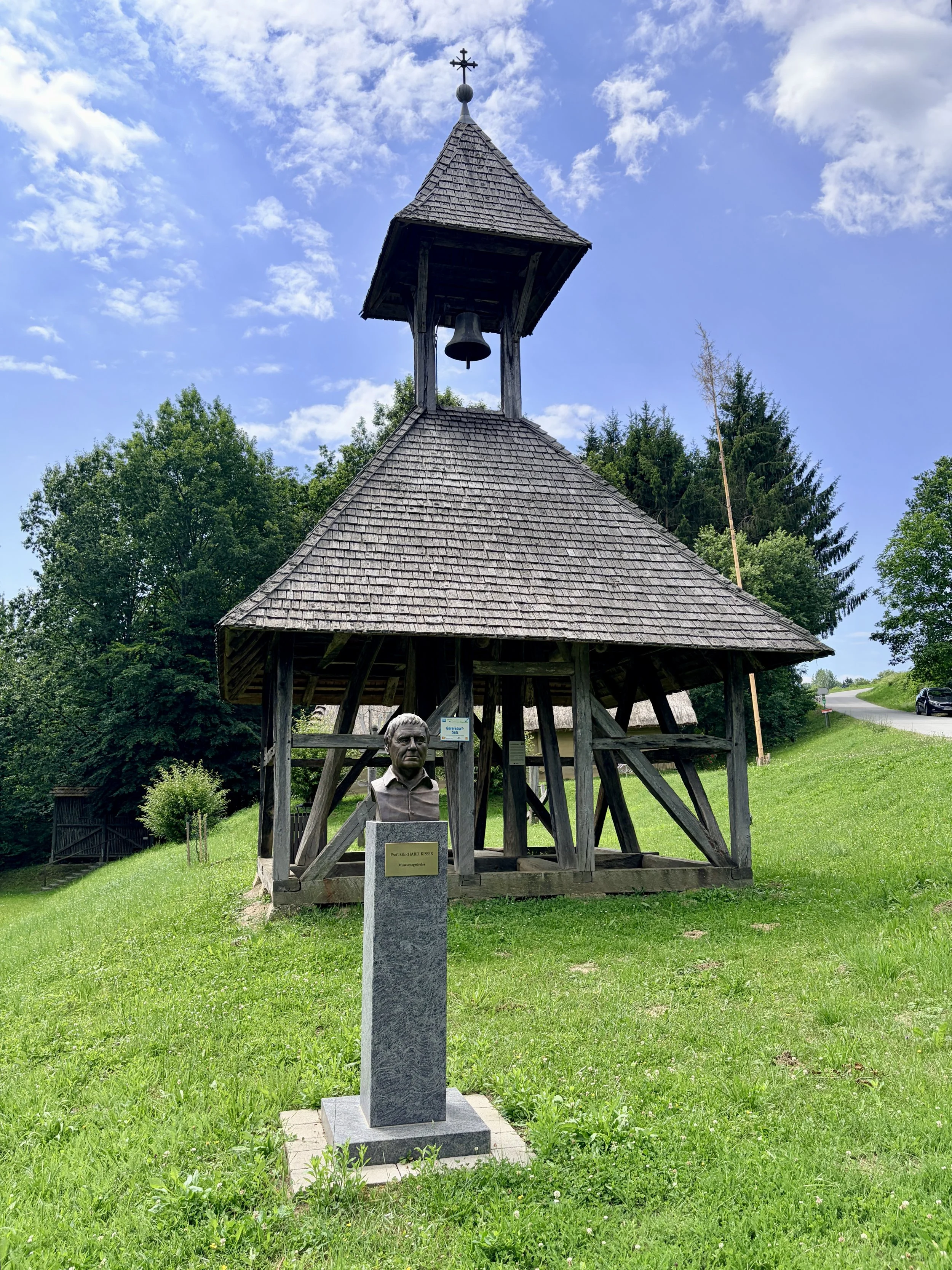
This monument to museum founder Founder Prof. Gerhard Kisser stands in front of the Bell Tower and May Pole.
By 1976, thanks to many volunteers putting in thousands of working hours, the first six buildings were presented to the public as the "Gerersdorf Ensemble." Over the years, it continued to grow, with all of the buildings and equipment coming from the Pannonian region. When I read about it online, I knew it was a place I wanted to see to better help me picture what life might have been like for my ancestors.
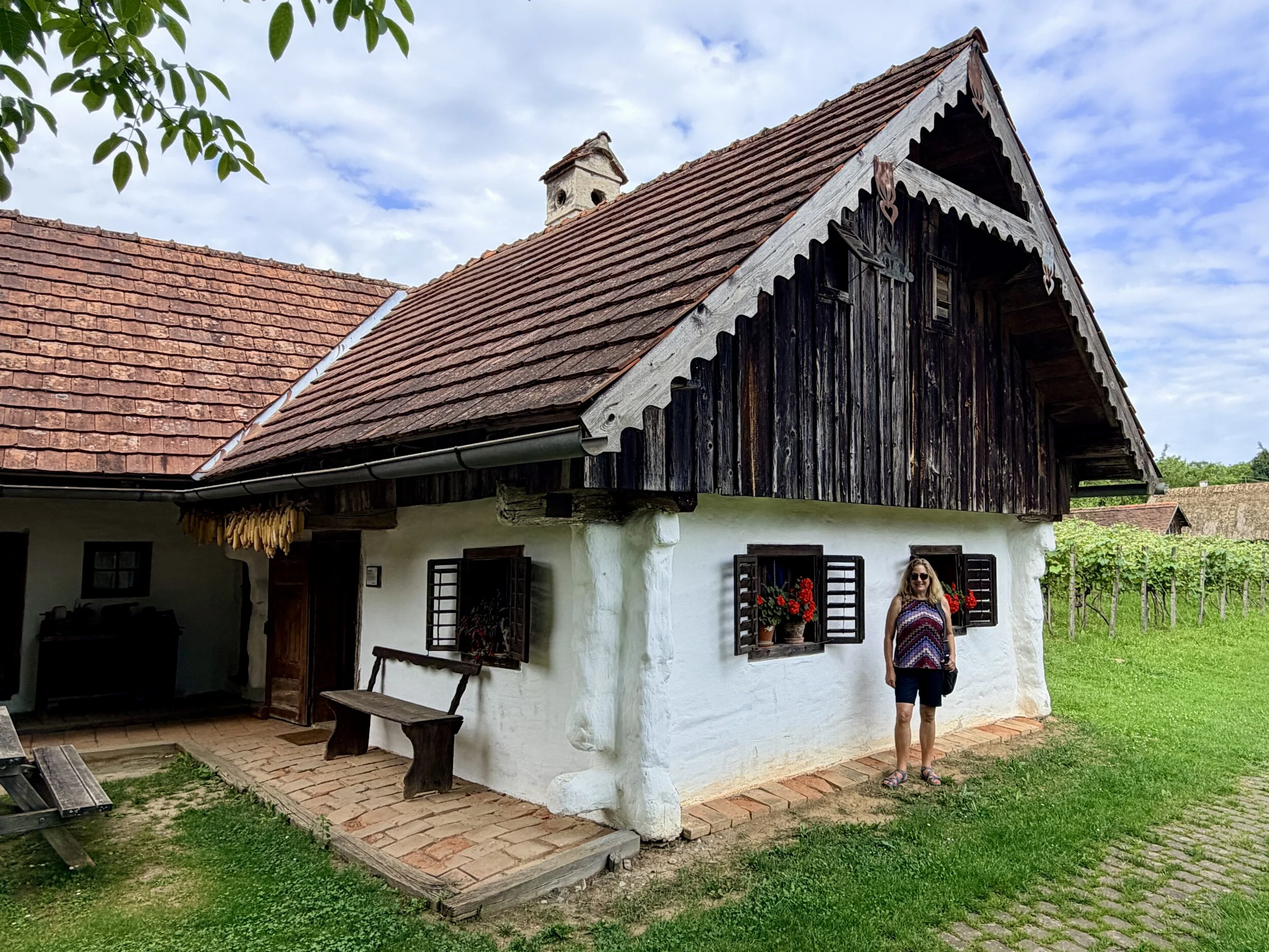
Here I am standing outside of one of several residences on display; you can see corn on the side hanging to dry.
Founder Prof. Gerhard Kisser transferred control of the museum to the "Friends of the Open-Air Museum Ensemble Gerersdorf" in 1996. It is now the group’s mission to “preserve and further develop as well as to care for Pannonian cultural heritage.” [9] One way they do this is by offering a “Summer Academy for the Preservation of Your Personal Cultural Heritage." Previous course listings include Furniture restoration, blacksmithing, welding, musical instrument making, photography, basket weaving, bobbin lace making, and instrument making, with all courses taking place in the museum's workshops, such as the carpenter's house, blacksmith's forge, or craftsmen's barn. If we had timed it right, I’m sure my husband would have been ready to sign up!
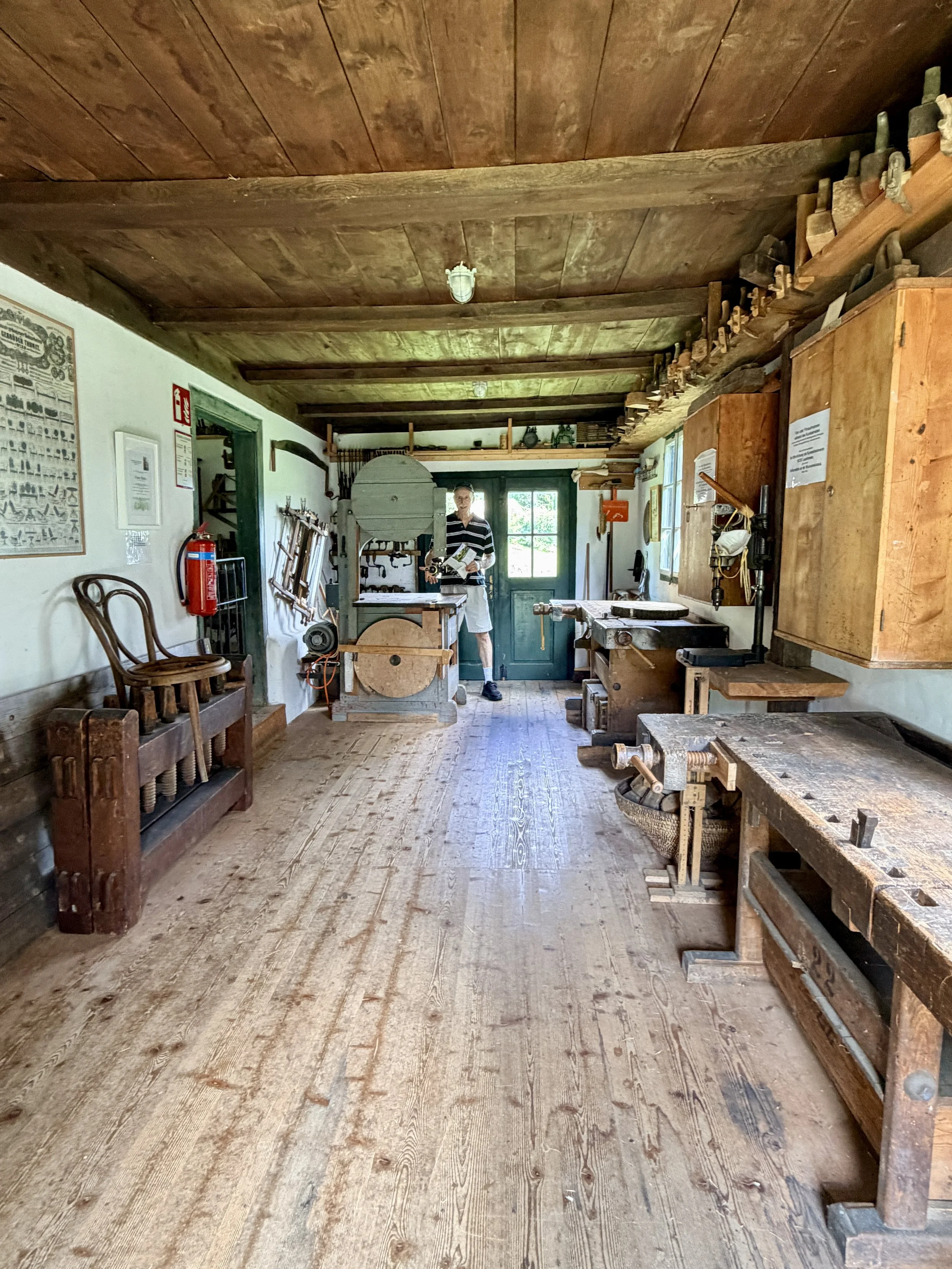
Mike is ready to do some woodworking at the Tischlerhaus (Carpenter’s Shop).
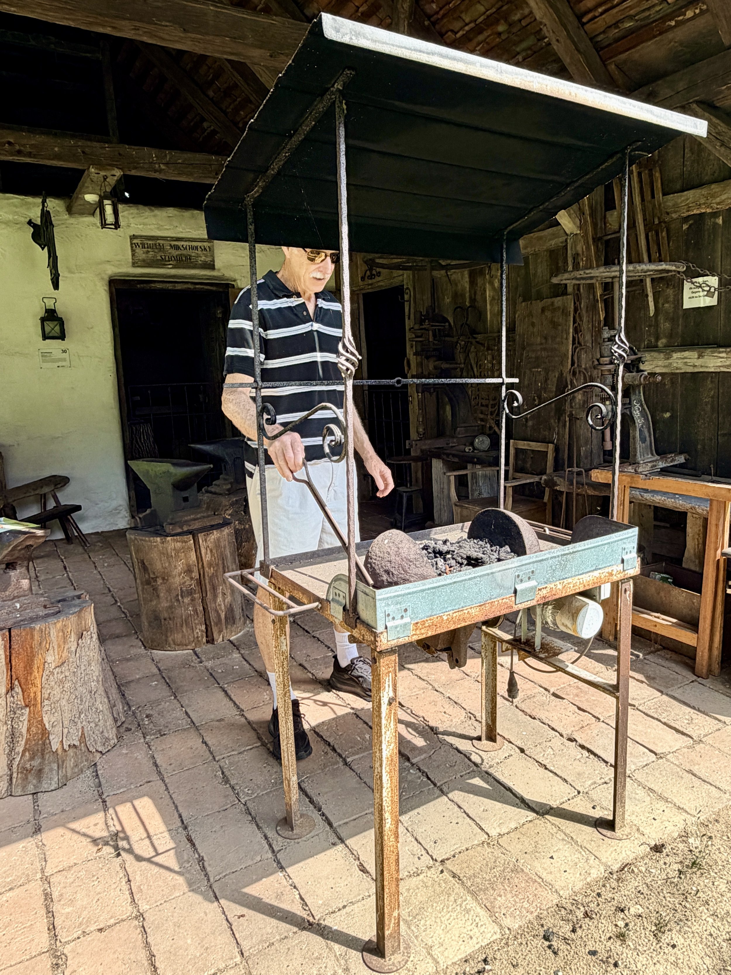
Now Mike is ready to try his hand at being a blacksmith at the Forge.
We topped off our visit with a look at the special art exhibit in the Tavern. Besides hosting special art exhibits, the museum hosts concerts, traditional events (such as the raising of the May Pole), museum days., and a special annual Children’s Day. We were glad we were able to work a visit into our schedule. After that, it was time to head to Graz to turn in our rental car, then fly to Berlin for the last stop on our three-week trip. We definitely enjoyed exploring Burgenland, and I know if we are able to someday return, we will have plenty more to see!
In my next post, to finish off this series, I will explore the immigration stories of my great grandparents, which mirror so many other Burgenlanders’ stories. They were among the thousands who moved to Chicago, making Chicago “Burgenland’s largest city.” To help tell that story, I will be taking you back to the Stadtvilla Eisenstadt Museum in Eisenstadt, as well as to the “back of the yards” and St. Augustine’s Church in Chicago, where John Wagner and Anna Halper met, worked, married, and gave birth to my grandfather. Stay tuned!
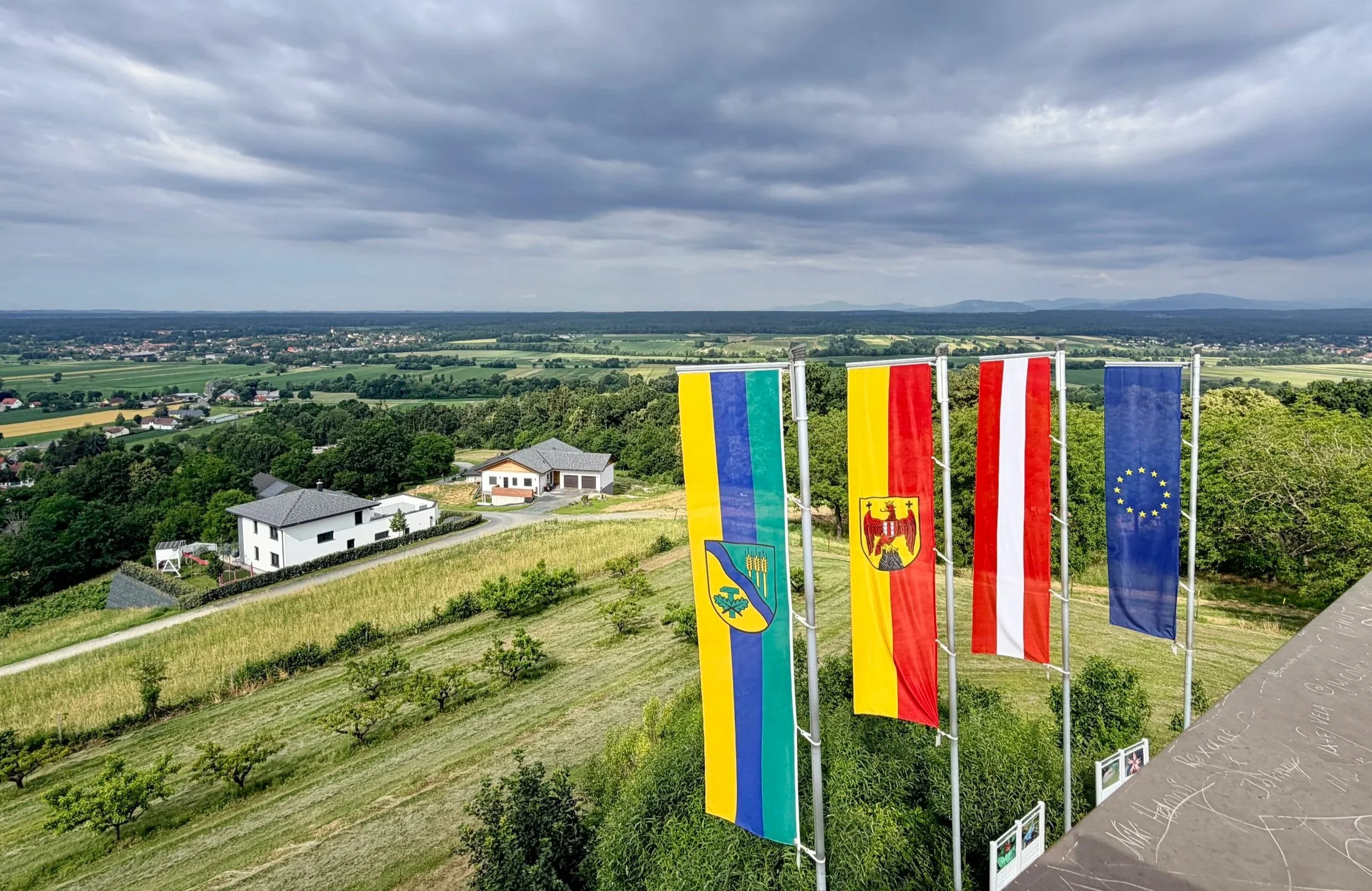
In this photo, taken from the Observation Tower, you can see the municipal flag Burgauberg-Neudauberg, the state flag of Burgenland, the national flag of Austria, and the flag of the European Union. Goodbye, Burgenland!
Endnotes:
“The Ancestral Seat Burg Güssing.” Batthyány-Strattmann, 2026, https://www.batthyany.at/burg-gussing/.
Ibid.
“Tradition and Heritage - Coat of Arms.” Virtualis, http://virtualis.sk-szeged.hu/kiallitas/batthyany/hagyomany.html.
“Batthyány Family Crest.” Batthyány-Strattmann, 2026,https://www.batthyany.at/wappen/.
Ibid.
“Blessed Ladislaus Prince Batthyány-Strattmann.” Batthyány-Strattmann, 2026, https://www.batthyany.at/der-selige-ladislaus/.
“Güssing Castle: A Historical Jewel in Southern Burgenland, Burg Güssing, 2026, https://burgguessing.at/.
“The Gerersdorf Ensemble Story.” Freilichtmuseum-Gerersdorf, 2026, https://www.freilichtmuseum-gerersdorf.at/geschicht.
Ibid.